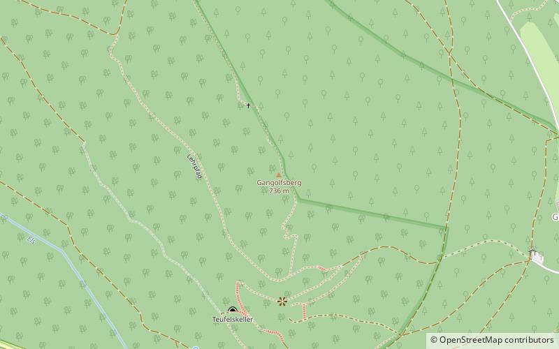
Gangolfsberg, Rhön Biosphere Reserve
#3 among attractions in Rhön Biosphere Reserve
Facts and practical information
Gangolfsberg is a mountain of Bavaria, Germany. ()
Rhön Biosphere Reserve Germany
Gangolfsberg – popular in the area (distance from the attraction)
Nearby attractions include: Black Moor, Rother Kuppe, Heidelstein, Rhön Mountains.
 Natural attraction, Nature, Mountain
Black Moor
89 min walk • Black Moor, or in German "Schwarzes Moor", is a natural jewel located in the mountainous region of the Bavarian Forest, near the border between Germany and the Czech Republic. This area, known for its harsh landscape and unique biological diversity, is home to one of...
 Natural attraction, Nature, Mountain
Rother Kuppe
34 min walk • Rother Kuppe is a mountain in Bavaria, Germany.
 Nature, Natural attraction, Mountain
Heidelstein
90 min walk • The Heidelstein, between Bischofsheim an der Rhön in the Bavarian county of Rhön-Grabfeld and Wüstensachsen in the Hessian county of Fulda, is a mountain, 925.7 m above sea level high, on the state border in the mountains of the High Rhön, part of the German Central Upland range of Rhön.
 Nature, Natural attraction, Volcano
Rhön Mountains
104 min walk • The Rhön Mountains are a group of low mountains in central Germany, located around the border area where the states of Hesse, Bavaria and Thuringia come together. These mountains, which are at the extreme southeast end of the East Hesse Highlands, are partly a result of ancient volcanic activity.
 Natural attraction, Nature, Mountain
Himmeldunkberg
159 min walk • The Himmeldunkberg or Himmeldunk is a 887.9 m above sea level m high, extinct volcano in the High Rhön in Germany. It straddles the Bavarian-Hessian state border.
 Natural attraction, Nature, Mountain
Stirnberg
70 min walk • Stirnberg is a mountain of Bavaria, Germany.
 Nature, Natural attraction, Mountain
Long Rhön
90 min walk • The Long Rhön is a ridge in the Central Rhön which forms part of the High Rhön within the Rhön Mountains. The Long Rhön is an elongated basalt plateau in the centre, roughly 800 metres above sea level, which is only occasional interrupted by mountain peaks. Its highest mountain is the Heidelstein.
 Forts and castles
Altenbrenda Castle, Rhön Biosphere Reserve
122 min walk • Altenbrenda Castle was is a lowland castle, now reduced to a burgstall, located in the Großer Garten, 1000 metres northeast of the present village of Unterweißenbrunn in the borough of Bischofsheim an der Rhön in the Lower Franconian county of Rhön-Grabfeld in Bavaria.
 National park
Red Moor
126 min walk • One of the highlights of a visit to Red Moor is the opportunity to observe the native wildlife in its natural habitat. Birdwatchers will be in their element here, as the moor is a haven for a variety of bird species, including rare and endangered birds such as the...
 Locality
Bischofsheim in der Rhön
145 min walk • One of the main draws of Bischofsheim in der Rhön is its stunning natural surroundings. The town is surrounded by lush forests, rolling hills, and meandering rivers, providing ample opportunities for outdoor activities such as hiking, cycling, and birdwatching.
 Town
TownFladungen
118 min walk • One of the town's most iconic landmarks is the Fladungen Castle, a stunning 14th-century fortress that offers breathtaking views of the surrounding countryside. Visitors can explore the castle's interior, which is filled with fascinating exhibits showcasing the...


