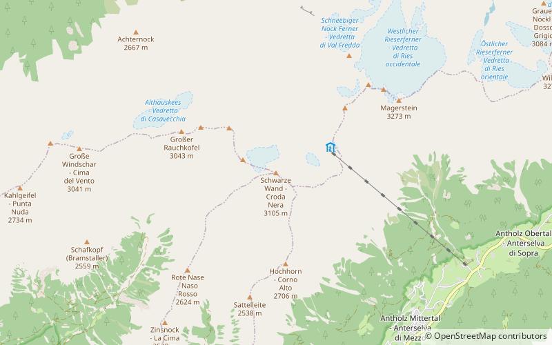
Schwarze Wand, Rieserferner-Ahrn Nature Park
#4 among attractions in Rieserferner-Ahrn Nature Park


Facts and practical information
The Schwarze Wand is a mountain of the Rieserferner group in South Tyrol, Italy. ()
Rieserferner-Ahrn Nature Park Italy
Schwarze Wand – popular in the area (distance from the attraction)
Nearby attractions include: Antholzer See, Schneebiger Nock, Durreck, Lenkstein.
 Alpine lake with lodging and recreation
Antholzer See, Rieserferner-Ahrn Nature Park
121 min walk • The Antholzer See is a lake in the Antholzertal in South Tyrol, Italy. It belongs to the municipality of Rasen-Antholz.
 Nature, Natural attraction, Mountain
Schneebiger Nock, Rieserferner-Ahrn Nature Park
42 min walk • The Schneebiger Nock, in old literature also called the Ruthnerhorn, is 3,358 metres high and, after the Hochgall, the second highest mountain of the Rieserferner Group, a range in the western part of the High Tauern.
 Nature, Natural attraction, Mountain
Durreck, Rieserferner-Ahrn Nature Park
141 min walk • The Durreck is the highest mountain in the Durreck Group, a South Tyrolean range that divides the Ahrntal valley in the north from the Reintal valley in the south.
 Nature, Natural attraction, Mountain
Lenkstein
154 min walk • The Lenkstein is a mountain in the Rieserferner group on the border between Tyrol, Austria, and South Tyrol, Italy.
 Nature, Natural attraction, Mountain
Großer Moosstock, Rieserferner-Ahrn Nature Park
126 min walk • The Großer Moosstock is a mountain in South Tyrol, Italy.
 Nature, Natural attraction, Mountain
Hochgall, Rieserferner-Ahrn Nature Park
100 min walk • The Hochgall is a mountain of the Rieserferner group in the High Tauern. the summit is in South Tyrol, Italy, just 500 m from the Austrian border.
 Nature, Natural attraction, Valley
Tauferer Ahrntal, Sand in Taufers
150 min walk • The Tauferer Ahrntal denotes the valley of the Ahr River, a tributary valley of the Puster Valley in South Tyrol, Italy. It is commonly divided into the Tauferer Tal, stretching from the confluence with the Rienz River near Bruneck up to Sand in Taufers, and the Ahrntal proper up to the source in Prettau.
 Nature, Natural attraction, Mountain
Wildgall, Rieserferner-Ahrn Nature Park
89 min walk • The Wildgall is, at 3,273 metres above sea level, the third highest peak in the Rieserferner Group, a range in the western part of the High Tauern.
 Nature, Natural attraction, Mountain
Ohrenspitzen
140 min walk • The Ohrenspitzen are three peaks on the border between Tyrol, Austria, and South Tyrol, Italy. They are a part of the Rieserferner Group in the Central Eastern Alps.
 Nature, Natural attraction, Mountain
Patscher Spitze, Rieserferner-Ahrn Nature Park
129 min walk • The Patscher Spitze is a mountain of the Rieserferner group on the border between Tyrol, Austria, and South Tyrol, Italy.
 46°55'24"N • 11°56'55"E
Burg Taufers, Sand in Taufers
156 min walk • History museum, Forts and castles
