Porta a Lucca, Pisa
Map
Gallery
Facts and practical information
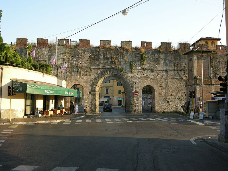
Porta a Lucca is one of the gates in the walls of Pisa, from which the residential neighborhood of the same name, inhabited by about 20,000 people, is named.
Coordinates: 43°43'21"N, 10°24'6"E
Address
Pisa
ContactAdd
Social media
Add
Day trips
Porta a Lucca – popular in the area (distance from the attraction)
Nearby attractions include: Leaning Tower of Pisa, Pisa Cathedral, Santa Chiara, Orto botanico di Pisa.
Frequently Asked Questions (FAQ)
Which popular attractions are close to Porta a Lucca?
Nearby attractions include Baths of Nero, Pisa (1 min walk), San Torpé, Pisa (2 min walk), Church of San Giuseppe, Pisa (2 min walk), San Tommaso delle Convertite, Pisa (3 min walk).
How to get to Porta a Lucca by public transport?
The nearest stations to Porta a Lucca:
Bus
Train
Bus
- V. del Brennero - Porta a Lucca • Lines: 70, Lucca-Pisa via Ripafratta, Lucca-Pisa via Santa Maria del G (1 min walk)
- V. Brennero Porta A Lucca • Lines: 70, Lucca-Pisa via Ripafratta, Lucca-Pisa via Santa Maria del G (2 min walk)
Train
- Pisa San Rossore (18 min walk)
- Pisa Centrale (26 min walk)

