Cima Valdritta
#284 among destinations in Italy

Facts and practical information
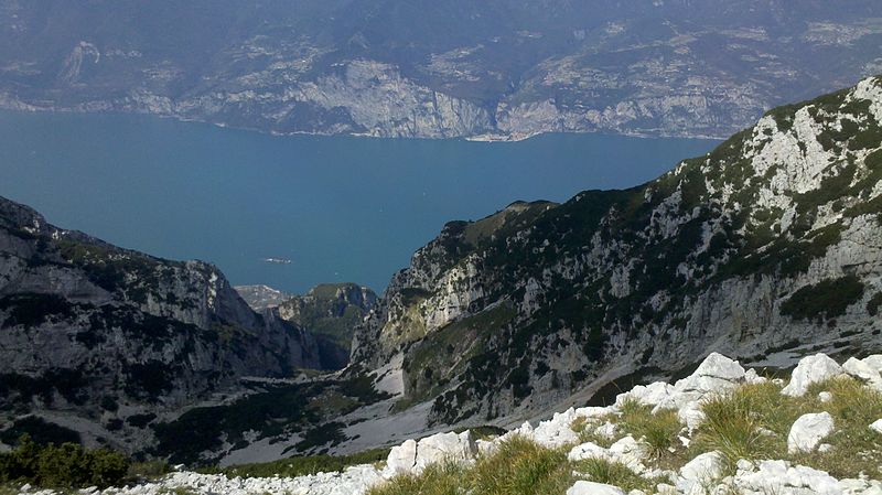
Cima Valdritta is the highest summit of the Monte Baldo mountain range and thereby part of the Garda Mountains in northern Italy. ()
VenetoItaly
Cima Valdritta plan & book
Unleash the traveler in you — discover the cheapest flight deals, find the perfect hotel or hostel nearby, and search for the best car rental prices. Travel at your own pace to discover new places and enjoy your journey.
Cima Valdritta – popular in the area (distance from the attraction)
Nearby attractions include: Castello di Avio, Castello Scaligero, Lago di Prà della Stua, Palazzo dei Capitani.
 Forts and castles, Historical place, History museum
Castello di Avio, Avio
138 min walk • The Castle of Avio is a medieval castle in the comune Avio, Trentino, northern Italy. It is currently held by the Fondo per l'Ambiente Italiano. It is one of the several castles commanding the Vallagarina valley of the Adige River. It features several rooms with medieval frescoes.
 View point, Forts and castles
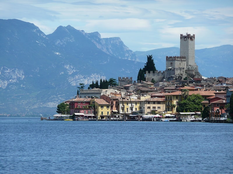
Castello Scaligero, Malcesine
83 min walk • The Scaliger Castle of Malcesine is a medieval castle in the town of Malcesine, a town on the northeastern shore of Lake Garda in the province of Verona.
 Nature, Natural attraction, Lake
Lago di Prà della Stua
107 min walk • Lago di Prà della Stua is a barrier lake in Trentino, Italy. The lake is at an elevation of 1050 m and retains the waters of the stream Torrente Aviana close to the country road Strada Provinciale dei Dossioli. Besides the Lago di Loppio this is the only major body of water in the Monte Baldo massif.
 Historical place, Architecture, Historic walking areas
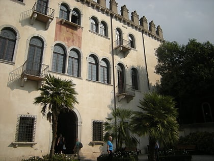
Palazzo dei Capitani, Malcesine
81 min walk • Palazzo Dei Capitani - a historic building in Malcesine, Italy, on the east shore of Lake Garda. In the 17th-19th centuries, the headquarters of the captains of Lake Garda, notifying the authorization of the Venetian Republic with...
 Mountain with a cable car to the top
Monte Baldo
18 min walk • Monte Baldo is a mountain range in the Italian Alps, located in the provinces of Trento and Verona. Its ridge spans mainly northeast-southwest, and is bounded from south by the highland ending at Caprino Veronese, from west by Lake Garda, from north by the valley joining Rovereto to Nago-Torbole and, from east, the Val d'Adige.
 Nature, Natural attraction, Mountain
Garda Mountains
6 min walk • The Garda Mountains, occasionally also the Garda Hills, are an extensive mountain range of the Southern Limestone Alps in northern Italy.
 Nature, Natural attraction, Mountain pass
Bocca di Navene
114 min walk • Bocca di Navene is a mountain saddle in the Monte Baldo range in the Garda Mountains in northern Italy. The saddle separates the more solitary Monte Altissimo di Nago in the north from the rest of the range with the long ridge with Cima Valdritta in the south.
 Nature, Natural attraction, Mountain
Cima delle Pozzette
17 min walk • Cima delle Pozzette is one of the highest summits of the Monte Baldo mountain range and thereby part of the Garda Mountains in northern Italy.
 Nature, Natural attraction, Mountain
Monte Altissimo di Nago
139 min walk • Monte Altissimo di Nago is one of the highest summits of the Monte Baldo mountain range and thereby part of the Garda Mountains in northern Italy.

 Botanical garden
Orto Botanico del Monte Baldo, Ferrara di Monte Baldo
96 min walk • The Orto Botanico del Monte Baldo, also known as the Orto Botanico di Novezzina or Orto Botanico d'Europa, is a botanical garden located at 1232 meters altitude on Monte Baldo, Via General Graziani 10, Novezzina, Ferrara di Monte Baldo, Province of Verona, Veneto, Italy.