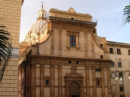
Via Roma, Palermo
Map

Map

Facts and practical information
Via Roma is an important street of Palermo. It represents one of the main axes of the historic centre and connect the Palermo Centrale railway station to the Teatro Politeama. Several important buildings of the city appears along the street's path. Via Roma was designed with the 1885 Master Plan of Palermo and built between 1894 and 1936. ()
Address
Centro Storico (Tribunali-Castellammare)Palermo
ContactAdd
Social media
Add
Day trips
Via Roma – popular in the area (distance from the attraction)
Nearby attractions include: Quattro Canti, Fontana Pretoria, Regional Archeological Museum Antonio Salinas, Santa Caterina.
Frequently Asked Questions (FAQ)
Which popular attractions are close to Via Roma?
Nearby attractions include Piazza San Domenico, Palermo (2 min walk), Museo del Risorgimento Vittorio Emanuele Orlando, Palermo (2 min walk), Church of San Domenico, Palermo (2 min walk), Oratory of Rosario di San Domenico, Palermo (3 min walk).
How to get to Via Roma by public transport?
The nearest stations to Via Roma:
Bus
Ferry
Tram
Train
Bus
- Roma - S. Domenico • Lines: 102 (1 min walk)
- Roma - Bandiera • Lines: 102 (1 min walk)
Ferry
- Palermo (16 min walk)
Tram
- Stazione Centrale • Lines: L1 (18 min walk)
- Ingrassia • Lines: L1 (22 min walk)
Train
- Palermo Centrale (19 min walk)
- Palermo Palazzo Reale-Orleans (22 min walk)


