Rifugio Auronzo, Auronzo di Cadore

Gallery (4)
Map

Map
Gallery
Facts and practical information
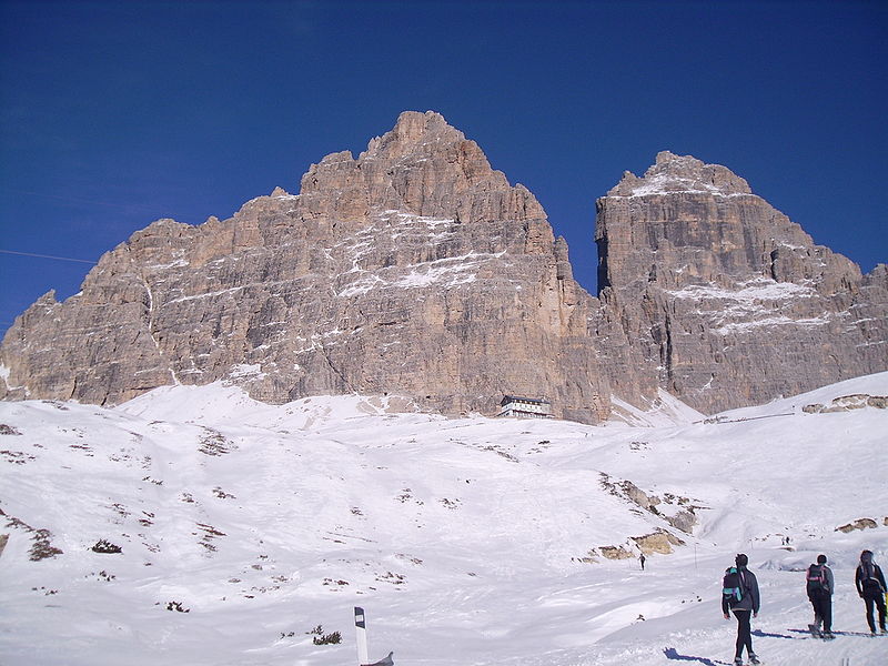
The Auronzo refuge is a mountain hut located near Forcella Longères, in the municipality of Auronzo di Cadore, in the province of Belluno, at 2,333 m above sea level. From the refuge there is a wide view of the Three Peaks of Lavaredo, Croda dei Toni, the Cadini di Misurina group, Mount Cristallo, Lake Misurina, and Val d'Ansièi. It is often used as a support point for the De Luca-Innerkofler via ferrata on Mt. Paterno, for the loop around the Tre Cime di Lavaredo, and for Alta via No. 4.
Day trips