Castello di Montegrossoli

Gallery (2)
Map

Map
Gallery
Facts and practical information
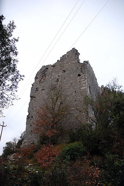
Montegrossoli Castle is a military structure, now reduced to ruins, located in Montegrossi, in the vicinity of Coltibuono Abbey, in the municipality of Gaiole in Chianti.
The castle is located on the top of a rise in the Chianti Mountains, on the border between the provinces of Florence and Arezzo at an elevation of about 700 meters. Its strategic location made it a very important place for controlling the areas straddling the Chianti and Upper Valdarno.
Coordinates: 43°29'0"N, 11°27'7"E
Location
Tuscany
ContactAdd
Social media
Add
Day trips
Castello di Montegrossoli – popular in the area (distance from the attraction)
Nearby attractions include: Castello di Brolio, Basilica di Santa Maria delle Grazie, Church of San Giovanni Battista, Chiesa di Santa Maria al Giglio.


