Castel Pietra
#2522 among destinations in Italy
![Castel Pietra location map](https://tzmedia.b-cdn.net/media/images/static-maps/it/46_1897_11_8596.jpg)
Facts and practical information
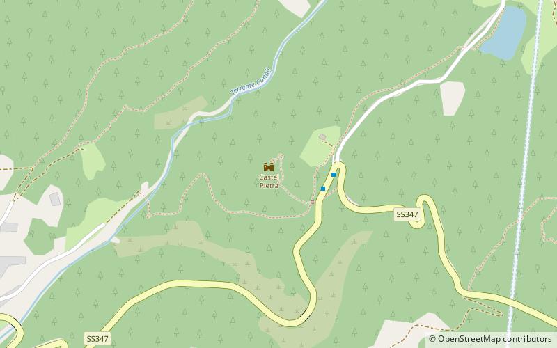
Castel Pietra is a castle in Trentino, Italy, in the Primiero valley.
It towers over the town of Tonadico, being located on an erratic boulder to the left of the state road to the Cereda Pass, at the mouth of the Val Canali.
Trentino-South TyrolItaly
Castel Pietra plan & book
Unleash the traveler in you — discover the cheapest flight deals, find the perfect hotel or hostel nearby, and search for the best car rental prices. Travel at your own pace to discover new places and enjoy your journey.
Castel Pietra – popular in the area (distance from the attraction)
Nearby attractions include: Lago di Calaita, Rifugio Rosetta "Giovanni Pedrotti", Primiero, Fiera di Primiero.
3.3 miWNature, Natural attraction, LakeLago di Calaita
84 min walk • Lago di Calaita, a serene alpine lake nestled in the picturesque setting of the Italian Dolomites, is a hidden gem waiting to be discovered. Surrounded by the verdant forests and the rugged peaks of the Lagorai chain, this tranquil body of water offers a respite from...
5.5 miNAlpine hut, HikingRifugio Rosetta "Giovanni Pedrotti", Dolomites
139 min walk • The Giovanni Pedrotti Refuge is located on the Rosetta Plateau in the Pale di San Martino Mountains at an elevation of 2,581 meters above sea level.
1.3 miWNature, Natural attraction, ValleyPrimiero, Transacqua
34 min walk • The Primiero is a valley located in the eastern part of Trentino, Italy. It consists of eight municipalities : Canal San Bovo, Fiera di Primiero, Imèr, Mezzano, Sagron Mis, Siròr, Tonadico and Transacqua.
1.7 miSWAreaFiera di Primiero, Transacqua
44 min walk • Fiera di Primiero was a comune in Trentino in the northern Italian region Trentino-Alto Adige/Südtirol, located about 60 kilometres east of Trento.
4.2 miNNature, Natural attraction, MountainVezzana, Dolomites
107 min walk • The Vezzana is the highest peak in the Pala group, a mountain range of the Dolomites, northern Italy. It is located in the northern part of the Dolomites, between the Taibon Agordino and Primiero comunes of Belluno and Trentino. It has an altitude of 3,192 metres.
5.3 miNNature, Natural attraction, Natural featurePala group, Dolomites
136 min walk • The Pala group is the largest massif of the Dolomites, with about 240 km² of surface, located between eastern Trentino and Veneto, in the area between Primiero, Valle del Biois and Agordino.
3.6 miSENature, Natural attraction, MountainSass de Mura, Dolomites
93 min walk • Sass de Mura is a mountain of the Dolomites in Veneto, Italy. It has an elevation of 2,547 metres.
3.8 miSNature, Natural attraction, ValleyNoana Valley
97 min walk • Noana valley is an uninhabited valley in eastern Trentino, Italy. It ends in Primiero valley. It's divided in three comunes: Imèr, Mezzano and Transacqua.
3.1 miNNature, Natural attraction, MountainSass Maòr, Dolomites
81 min walk • Sass Maor is one of the most famous peaks in the Pale di San Martino and the entire Dolomites and, like the Three Peaks of Lavaredo, a monument to the history of mountaineering in the Dolomites.
4.4 miNNature, Natural attraction, MountainPala di San Martino, Dolomites
114 min walk • The Pala di San Martino is one of the most famous peaks of the Pale di San Martino, clearly visible from San Martino di Castrozza, with elegant and slender forms on all sides.
3.4 miENature, Natural attraction, MountainPiz di Sagron, Dolomites
88 min walk • The Cimonega Group is a dolomite mountain massif belonging to the Feltrine Alps. It is located in the province of Belluno and the province of Trento and is part of the Belluno Dolomites National Park.