Ponte Lambro, Milan
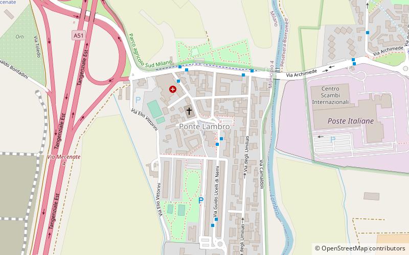
Map
Facts and practical information
Address
Zona 4 (Parco Monlué - Ponte Lambro)Milan
ContactAdd
Social media
Add
Getting there by public transportation
Public transportation stops near this location
- Metro
- Bus
- Tram
 Metro
Metro
- Calculate routeVia Ucelli di Nemi - Via Serrati 2 min walk
- Calculate routeOspedale Monzino 4 min walk
- Calculate routeVia Vittorini Via Umiliati 4 min walk
- Calculate routeViale Ungheria - Via Mecenate 13 min walk
- Calculate routeVia Mecenate - Via Fantoli 22 min walk
- Calculate routeSan Donato 26 min walk
Maps Metro
Metro
MetroDay trips


Frequently Asked Questions (FAQ)
How to get to Ponte Lambro by public transport?
The nearest stations to Ponte Lambro:
Bus
Tram
Metro
Bus
- Via Ucelli di Nemi - Via Serrati • Lines: 45 (2 min walk)
- Ospedale Monzino • Lines: 45, 66 (4 min walk)
Tram
- Viale Ungheria - Via Mecenate • Lines: 27 (13 min walk)
- Via Mecenate - Via Fantoli • Lines: 27 (22 min walk)
Metro
- San Donato • Lines: M3 (26 min walk)