San Saba, Rome
Map
Facts and practical information
San Saba is the 21st rione of Rome, identified by the initials R. XXI. It is located within the Municipio I, and takes its name from the Basilica of San Saba, which is located there. ()
Address
Sant'SabaRome
ContactAdd
Social media
Add
Getting there by public transportation
Public transportation stops near this location
- Metro
- Bus
- Tram
- Light rail
- Ferry
 Metro
Metro
- Calculate routeGuerrieri 4 min walk
- Calculate routeL. B. Alberti 5 min walk
- Calculate routeBaccelli 5 min walk
- Calculate routeChiarini/Guerrieri 5 min walk
- Calculate routeAventino/Albania 10 min walk
- Calculate routeAlbania 10 min walk
- Calculate routePorta San Paolo 13 min walk
- Calculate routeCirco Massimo 10 min walk
- Calculate routePiramide 13 min walk
- Calculate routeColosseo 23 min walk
- Calculate routeGarbatella 24 min walk
- Calculate routeRoma Porta San Paolo 14 min walk
- Calculate routeIsola Tiberina 29 min walk
Maps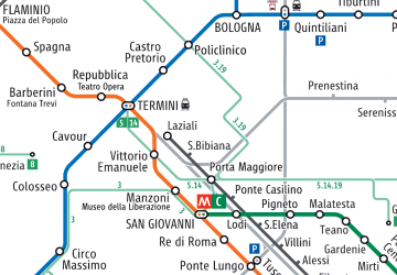 Metro / Tram / Rail
Metro / Tram / RailDay trips


Frequently Asked Questions (FAQ)
Which popular attractions are close to San Saba?
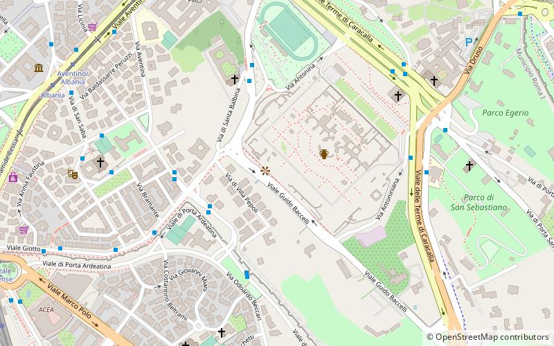
Nearby attractions include Terme di Caracalla, Rome (4 min walk), Santa Balbina, Rome (5 min walk), Chiesa dei Santi Nereo e Achilleo, Rome (6 min walk), Aurelian Walls, Rome (7 min walk).
How to get to San Saba by public transport?
The nearest stations to San Saba:
Bus
Tram
Metro
Light rail
Ferry
Bus
- Guerrieri • Lines: 160 (4 min walk)
- L. B. Alberti • Lines: 715 (5 min walk)
Tram
- Aventino/Albania • Lines: 3, 8 (10 min walk)
- Albania • Lines: 3, 8 (10 min walk)
Metro
- Circo Massimo • Lines: B (10 min walk)
- Piramide • Lines: B (13 min walk)
Light rail
- Roma Porta San Paolo • Lines: Fc2 (14 min walk)
Ferry
- Isola Tiberina • Lines: Battelli di Roma (29 min walk)