Wetlina
#179 among destinations in Poland
![Wetlina location map](https://tzmedia.b-cdn.net/media/images/static-maps/pl/49_15369_22_46904.jpg)
![Wetlina](https://tzmedia.b-cdn.net/media/images/pl/place/gallery/medium/a7fe97fe058af31ed2def1b8187d45ce.jpg)
Facts and practical information
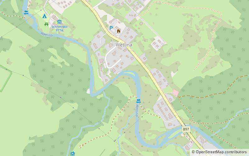
Wetlina is a village with a population of 307 located in south-eastern Poland in the Subcarpathian Voivodeship, near the border with Slovakia. It is near the entrance to Bieszczady National Park and is situated along the Wetlinka river. ()
SubcarpathianPoland
Wetlina plan & book
Unleash the traveler in you — discover the cheapest flight deals, find the perfect hotel or hostel nearby, and search for the best car rental prices. Travel at your own pace to discover new places and enjoy your journey.
Wetlina – popular in the area (distance from the attraction)
Nearby attractions include: Kremenec mountain, Ďurkovec mountain, Hasiakowa Skała, Wielka Rawka.
6.3 miSENature, Natural attraction, MountainKremenec mountain, Poloniny
161 min walk • Krzemieniec - a mountain peak in the watershed range of the Western Bieszczady Mountains. Height - 1221 m.
4.2 miSWNature, Natural attraction, MountainĎurkovec mountain, Poloniny
108 min walk • Dziurkowiec - a peak with an altitude of 1189 m in the Western Bieszczady Mountains. It is located on the main ridge of the border range, between Płasza and Ryba Skała, on the Polish-Slovakian border.
3.7 miENature, Natural attraction, MountainHasiakowa Skała, Bieszczady National Park
96 min walk • Hasiakowa Skała - the easternmost peak of Połonina Wetlińska in the Bieszczady Mountains, located north of the Wyżna Pass and west of the Prowcza Creek valley. A side ridge of Jawornik and Dwernik Kamień, extending northward from the peak to the...
6.1 miSENature, Natural attraction, MountainWielka Rawka, Bieszczady National Park
156 min walk • Wielka Rawka - the highest peak of the border range in the Western Bieszczady Mountains.
3.7 miSNature, Natural attraction, MountainRabia skala
95 min walk • Riaba Skała - peak in the border range of the Western Bieszczady Mountains, on the Polish-Slovakian border.
2.3 miNNature, Natural attraction, MountainSmerek, Bieszczady National Park
60 min walk • Smerek - a peak in the Western Bieszczady. This is the name under which it is most often described on maps and in guidebooks. On some maps, however, it is described as Wysoka.
2.7 miENature, Natural attraction, MountainOsadzki Wierch, Bieszczady National Park
69 min walk • Osadzki Wierch - the second highest and highest trail accessible peak in the Połonina Wetlinska range in the Western Bieszczady Mountains.
5.6 miSENature, Natural attraction, MountainMała Rawka, Bieszczady National Park
144 min walk • Mala Rawka - a mountain that is the culmination of the Dział ridge. It is located near the village Ustrzyki Górne in the Western Bieszczady. To the northeast diverges the ridge, through the Wyżniańska Pass running towards Połonina Caryńska.
2.2 miNENature, Natural attraction, MountainHnatowe Berdo, Bieszczady National Park
56 min walk • Hnatowe Berdo - a not very prominent culmination of Połonina Wetlinska in the Western Bieszczady Mountains. It is located west of Osadzki Wierch, as the end of a short side ridge. The summit part is covered by the forest.
5.7 miENature, Natural attraction, MountainWyżniański Wierch, Bieszczady National Park
146 min walk • Wyżniański Peak - a peak in the Western Bieszczady Mountains, located southwest of the Wyżniańska Pass. It is a gentle, grassy and not high hill located between the lofty massifs of Połonina Caryńska and Mała Rawka.
2.8 miENature, Natural attraction, MountainRoh, Bieszczady National Park
73 min walk • Roh - the highest peak of Połonina Wetlińska in the Western Bieszczady. The peak is the culmination of the grehoty-covered ridge located between the Silver Pass separating it from Osadzki Wierch and Hasiakowa Skała and is situated in its...