Rodley Nature Reserve

Facts and practical information
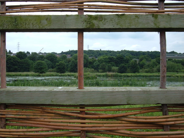
The Rodley Nature Reserve is a wetland reserve created in 1999 on the site of a former sewage works on the outskirts of Rodley, West Yorkshire, United Kingdom. It is situated just north of Town Street on the north bank of the River Aire. ()
England
Best Ways to Experience the Park
Wildlife
AnimalsSee what popular animal species you can meet in this location.
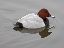
Common pochard
The common pochard is a medium-sized diving duck renowned for its distinctive appearance and widespread distribution across Europe and Asia. Scientifically named from Greek and Latin roots, the adult male pochard is notable for its striking red head and neck, black...
Birds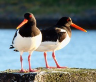
Eurasian oystercatcher
The Eurasian oystercatcher, often simply referred to as the oystercatcher, is a captivating bird known by several names, including the common pied oystercatcher and the palaearctic oystercatcher. It belongs to the Haematopodidae family and is widely distributed across...
Birds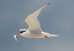
Common tern
The common tern, a seabird belonging to the Laridae family, is renowned for its extensive migratory behavior, with four subspecies dispersed across Europe, Asia, and North America. These birds exhibit a strong preference for migration, wintering in the warmer coastal...
Birds
Common European Toad
The common toad, also known as the European toad, is an amphibian found across Europe, western North Asia, and parts of Northwest Africa. It belongs to a group of related species that share a common ancestor. These toads are typically inactive during the day, emerging...
Amphibians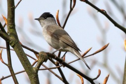
Eurasian blackcap
The Eurasian blackcap, often simply called the blackcap, is a charming and widespread warbler found across Europe, western Asia, and northwestern Africa. With its olive-grey upperparts and pale grey underparts, the blackcap is easily recognizable by the distinct cap on...
Birds


