Grand Canyon National Park: Mountain
Places and attractions in the Mountain category
Categories
- Mountain
- Hiking trail
- Hiking
- Butte
- Outdoor activities
- Park
- Nature
- Natural attraction
- Canyon
- Cliff
- Vernacular architecture
Pollux Temple
Pollux Temple is a 6,251-foot-elevation summit in the Grand Canyon, in Coconino County of northern Arizona, US. It is situated ten miles northwest of Grand Canyon Village, and less than one mile northeast of Jicarilla Point.
The Battleship
The Battleship is a 5,850-foot-elevation summit located in central Grand Canyon, in Coconino County of northern Arizona, United States.
Zoroaster Temple
Zoroaster Temple is a 7,123-foot-elevation summit located in the Grand Canyon, in Coconino County of Arizona, USA. It is situated 5.5 miles northeast of the Yavapai Point overlook on the canyon's South Rim, from which it can be seen towering over 4,600 feet above the Colorado River and Granite Gorge.
Mount Hayden
Mount Hayden is an 8,362-foot-elevation summit located in the Grand Canyon, in Coconino County of Arizona, United States. It is situated one-half mile southeast of the Point Imperial viewpoint, on the canyon's North Rim, where it towers 5,000 feet above the bottom of Nankoweap Canyon.
Cheops Pyramid
Cheops Pyramid is a 5,401-foot-elevation summit located in the Grand Canyon, in Coconino County of Arizona, US. This butte is situated four miles north of Grand Canyon Village, 2.5 miles south-southwest of Buddha Temple, and 1.7 mile south-southeast of Isis Temple, which is the nearest higher neighbor.
Brady Peak
Brady Peak is an 8,121-foot-elevation summit located in the Grand Canyon, in Coconino County of northern Arizona, United States.
Vesta Temple
Vesta Temple is a 6,299-foot-elevation summit located in the Grand Canyon, in Coconino County of northern Arizona, US. It is situated eight miles west-northwest of Grand Canyon Village, and immediately northeast of Mimbreno Point.
Dragon Head
Dragon Head is a 7,765-foot elevation summit located in the Grand Canyon, in Coconino County of Arizona, US. It is situated in the north of the Hindu Amphitheater, ~2.0 miles west of Shiva Temple, and ~2.5 mi southeast of Grama Point.
Sheba Temple
Sheba Temple is a 4,990-foot-elevation summit located in the eastern Grand Canyon, in Coconino County of northern Arizona, United States.
Angels Gate
Angels Gate is a 6,761-foot-elevation summit located in the Grand Canyon, in Coconino County of Arizona, United States. It is situated seven miles due north of the Grandview Point overlook on the canyon's South Rim, three miles west of Vishnu Temple, and three point five miles southeast of Zoroaster Temple.
Tower of Set
Tower of Set is a 6,012-foot-elevation summit located in the Grand Canyon, in Coconino County of Arizona, US. This butte is situated four miles north of Hopi Point overlook on the canyon's South Rim, two miles southeast of Tower of Ra, and three miles south-southwest of Shiva Temple, where it towers 3,600 feet above the Colorado River.
Vishnu Temple
Vishnu Temple is a 7,533-foot-elevation summit located in the Grand Canyon, in Coconino County of Arizona, US. It is situated two miles south-southeast of the Cape Royal overlook on the canyon's North Rim, 1.5 mile south of Freya Castle, and two miles east-southeast of Wotans Throne, its nearest higher neighbor.
Freya Castle
Freya Castle is a 7,288-foot-elevation summit located in the Grand Canyon, in Coconino County of northern Arizona, US. It is situated one mile southeast of the Cape Royal overlook on the canyon's North Rim, 1.5 mile north of Vishnu Temple, and 1.7 mile northeast of Wotans Throne.
Deva Temple
Deva Temple is a 7,353-foot-elevation summit located in the Grand Canyon, in Coconino County of northern Arizona, USA. It is situated three miles south of the North Rim's Bright Angel Point, and towers 3,700 feet above Bright Angel Canyon.
Coronado Butte
Coronado Butte is a 7,162-foot-elevation summit located in the Grand Canyon, in Coconino County of Arizona, United States. It is situated one mile west of the Moran Point overlook on the canyon's South Rim, and one mile northeast of Sinking Ship, its nearest higher neighbor.
Sinking Ship
Sinking Ship is a 7,344-foot elevation summit located in the Grand Canyon, in Coconino County of northern Arizona, United States.
The Howlands Butte
The Howlands Butte, elevation 5,572 feet, is a minor butte in the southeast drainage of the very large Clear Creek drainage. Clear Creek is a medium length flowing creek, just upstream of the major Bright Angel Creek outfall into the Colorado River, Granite Gorge.
Horseshoe Mesa
Horseshoe Mesa is a 5,246-foot-elevation mesa-summit located in the eastern Grand Canyon, in Coconino County of northern Arizona, US.
Rama Shrine
Rama Shrine is a 6,406-foot-elevation platform-summit located in the eastern Grand Canyon, in Coconino County of northern Arizona, United States. The Shrine is named for Rama, the Hindu god of chivalry and virtue.
Jupiter Temple
Jupiter Temple is a 7,084-foot-elevation summit located in the Grand Canyon, in Coconino County of northern Arizona, United States.
Gunther Castle
Gunther Castle is a 7,199-foot-elevation summit located in the Grand Canyon, in Coconino County of northern Arizona, US. It is situated three miles northwest of Chuar Butte, between Kwagunt Valley to the north, and Chuar Valley to the south.
Holy Grail Temple
Holy Grail Temple is a 6,711-foot-elevation summit located in the Grand Canyon, in Coconino County of northern Arizona, US. It is situated seven miles north-northeast of Havasupai Point, and two miles west-northwest of King Arthur Castle, within the Shinumo Amphitheater.
Hubbell Butte
Hubbell Butte is a 6,740 ft-elevation summit located in the eastern Grand Canyon, in Coconino County of northern Arizona, United States. It is situated ~1.5 miles northeast of Cape Final.
Cardenas Butte
Cardenas Butte is a 6,281-foot-elevation summit located in the eastern Grand Canyon, in Coconino County of northern Arizona, Southwestern United States. Cardenas Butte is named for García López de Cárdenas, the first European to see the Grand Canyon.
Krishna Shrine
Krishna Shrine is a 6,131-foot-elevation summit located in the eastern Grand Canyon, in Coconino County of northern Arizona, US. The landform is attached at the southwest to the Vishnu Temple massif, about 1.0 mi distant. Krishna Shrine is about 3.0 mi south of the Cape Royal overlook, Walhalla Plateau.
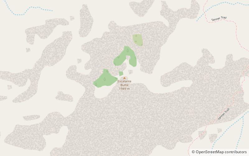
Escalante Butte
Escalante Butte is a 6,536-foot prominence adjacent the far eastern South Rim of the Grand Canyon, of Northern Arizona. Adjacent east is a lower elevation butte, Cardenas Butte.
The Alligator
The Alligator, is a 5,774-foot-elevation summit, a large ridgeline butte, connected to, and below Mohave Point, approximately 1.5 miles northwest of Grand Canyon Village, Grand Canyon.
Tower of Ra
Tower of Ra is a 6,129-foot-elevation pillar located in the Grand Canyon, in Coconino County of Arizona, US.
Thor Temple
Thor Temple is a 6,741-foot-elevation summit located in the Grand Canyon, in Coconino County of northern Arizona, United States.
Juno Temple
Juno Temple is a 6,896-elevation summit located in the eastern Grand Canyon, in Coconino County of northern Arizona, United States.
King Arthur Castle
King Arthur Castle is a 7,344-foot-elevation summit located in the Grand Canyon, in Coconino County of northern Arizona, US. It is situated one-half mile northwest of Guinevere Castle, one mile west of Excalibur, and two miles east-southeast of Holy Grail Temple, within the Shinumo Amphitheater.
Dunn Butte
Dunn Butte, is a 5,714 foot-elevation-summit, a minor butte, along a line of three summits along the west drainage of Ninetyone Mile Canyon and Creek. From higher elevation-to-lower, they are Angels Gate, Dunn Butte, and Hawkins Butte.
Guinevere Castle
Guinevere Castle is a 7,281-foot-elevation summit located in the Grand Canyon, in Coconino County of northern Arizona, US. It is situated one-half mile southeast of King Arthur Castle, one mile west of Excalibur, and 2.5 miles northeast of Evans Butte, within the Shinumo Amphitheater.
Siegfried Pyre
Siegfried Pyre is a 7,922-foot-elevation summit located in the eastern Grand Canyon, in Coconino County of northern Arizona, United States. It is situated adjacent to the eastern North Rim, specifically, to the east face of the Walhalla Plateau. It is southeast of Atoko Point and northeast of Naji Point.
Mencius Temple
Mencius Temple, is a 7,001 ft major butte, part of the twin buttes of Confucius and Mencius Temples, near the beginning of Western Grand Canyon.
Newton Butte
Newton Butte, in the Grand Canyon, Arizona, United States is a prominence below the South Rim, northwest of Grandview Point, and north on a ridgeline from Shoshone Point which is one mile east of Yaki Point, East Rim Drive.
Geikie Peak
Geikie Peak is a 5,005-foot-elevation summit located in the Grand Canyon, in Coconino County of northern Arizona, United States.
Isis Temple
Isis Temple is a prominence in the Grand Canyon, Arizona, Southwestern United States. It is located below the North Rim and adjacent to Granite Gorge.
Wotans Throne
Wotans Throne is a 7,721-foot-elevation summit located in the Grand Canyon, in Coconino County of Arizona, US. It is situated one mile immediately southwest of the Cape Royal overlook on the canyon's North Rim, 1.7 mile west-southwest of Freya Castle, two miles west-northwest of Vishnu Temple, and five miles east of Zoroaster Temple.
Tritle Peak
Tritle Peak is an 8,388-foot prominence adjacent Roosevelt Point, on the East Rim of the Walhalla Plateau. It is located in far eastern Grand Canyon, of Northern Arizona.
Venus Temple
Venus Temple is a 6,281-foot-elevation summit located in the eastern Grand Canyon, in Coconino County of northern Arizona, US. The landform is attached to Apollo Temple immediately south-southeast.
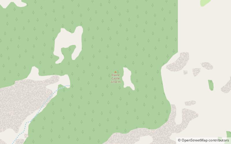
Elaine Castle
Elaine Castle is a 7,431-foot-elevation summit located in the Grand Canyon, in Coconino County of northern Arizona, US. It is situated three miles north-northwest of King Arthur Castle near the head of Shinumo Creek, and immediately southwest of Lancelot Point.
Osiris Temple
Osiris Temple is a 6,613 ft elevation summit located in the Grand Canyon, in Coconino County of Arizona, US. This butte is situated approximately southwest of Shiva Temple, in the Upper Trinity Creek watershed, a north watershed into the Colorado River at Granite Gorge.
Temple Butte
Temple Butte, in the Grand Canyon, Arizona, US is a prominence below the East Rim. The butte lies on the west bank of the south-flowing Colorado River.
Horus Temple
Horus Temple is a 6,150 ft elevation summit located in the Grand Canyon, in Coconino County of Arizona, Southwestern United States.
Map

