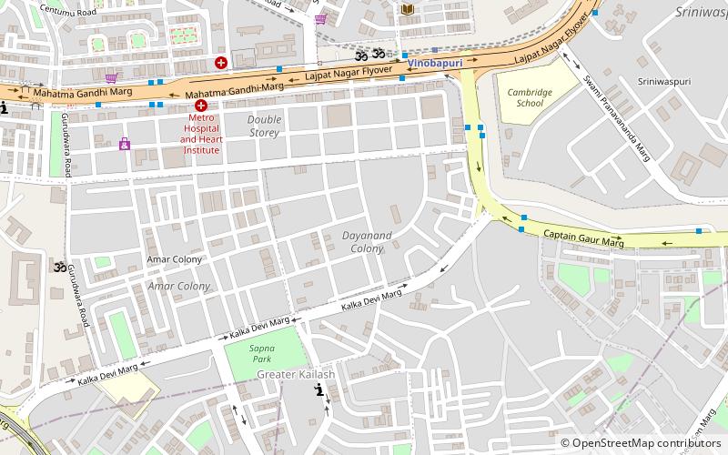
Dayanand Colony, Delhi
Map
Facts and practical information
Dayanand Colony is part of the Lajpat Nagar area of Delhi. It falls under Lajpat Nagar-4 in South Delhi. By 1957, it was named after Dayanand Saraswati. ()
Coordinates: 28°33'44"N, 77°14'51"E
Address
South Delhi (Defence Colony)Delhi
ContactAdd
Social media
Add
Getting there by public transportation
Public transportation stops near this location
- Metro
- Bus
- Train
 Metro
Metro
- Calculate routeLajpat Nagar Crossing 6 min walk
- Calculate routeLajpat Nagar 6 min walk
- Calculate routeGarhi Village 6 min walk
- Calculate routeLajpat Nagar Ring Road 7 min walk
- Calculate routeVinobapuri 7 min walk
- Calculate routeKailash Colony 15 min walk
- Calculate routeLajpat Nagar 19 min walk
- Calculate routeNehru Place 20 min walk
- Calculate routeOkhla 29 min walk
- Calculate routeLajpat Nagar 31 min walk
Maps Metro
Metro
MetroDay trips


Frequently Asked Questions (FAQ)
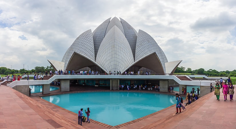
Which popular attractions are close to Dayanand Colony?
Nearby attractions include ISKCON Temple, Delhi (10 min walk), Vikram Vihar, Delhi (17 min walk), Aastha Kunj Park, Delhi (19 min walk), Lotus Temple, Delhi (23 min walk).
How to get to Dayanand Colony by public transport?
The nearest stations to Dayanand Colony:
Bus
Metro
Train
Bus
- Lajpat Nagar Crossing • Lines: (-) Oms, (+) Oms, 311A, 411, 427, 429, 433, 469, 47A, 480, 492 (6 min walk)
- Lajpat Nagar • Lines: 410, 410A, 411, 433, 47A, 480, 507 (6 min walk)
Metro
- Vinobapuri • Lines: Pink Line (7 min walk)
- Kailash Colony • Lines: Violet Line (15 min walk)
Train
- Okhla (29 min walk)
- Lajpat Nagar (31 min walk)