Tschigat, Texelgruppe Nature Park

Gallery (2)
Map
Map
Gallery
Facts and practical information
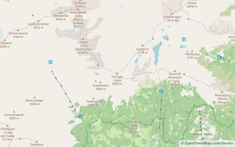
Tschigat is a place located in Texelgruppe Nature Park (Trentino-South Tyrol autonomous region) and belongs to the category of natural attraction, mountain.
It is situated at an altitude of 9695 feet, and its geographical coordinates are 46°43'12"N latitude and 11°3'37"E longitude.
Among other places and attractions worth visiting in the area are: Schutzhaus Hochgang (hiking, 34 min walk), Lodner (natural attraction, 35 min walk), Spronser Lakes (lake, 40 min walk).
Address
Texelgruppe Nature Park
ContactAdd
Social media
Add
Day trips


