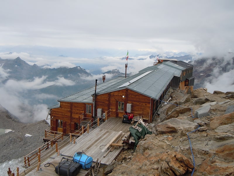
Rifugio Zamboni Zappa
#6040 among destinations in Italy


Facts and practical information
The Zamboni-Zappa refuge is a refuge located in the municipality of Macugnaga, in the Anzasca Valley in the Pennine Alps, at 2070 m above sea level.
Rifugio Zamboni Zappa plan & book
Unleash the traveler in you — discover the cheapest flight deals, find the perfect hotel or hostel nearby, and search for the best car rental prices. Travel at your own pace to discover new places and enjoy your journey.
Rifugio Zamboni Zappa – popular in the area (distance from the attraction)
Nearby attractions include: Margherita Hut, Gnifetti Hut, Signalkuppe, Parrotspitze.
 Alpine hut, Hiking, Outdoor activities
Margherita Hut
68 min walk • Perched high in the Italian Alps, the Margherita Hut stands as a testament to human tenacity and the spirit of mountaineering. At an astonishing elevation of 4,554 meters, it is the highest alpine hut in Europe, offering shelter and respite to climbers braving the...
 Alpine hut, Hiking, Mountain hut
Gnifetti Hut
126 min walk • Perched on the gnarled ridges of the Monte Rosa massif, the Gnifetti Hut serves as a beacon for mountaineers and alpine enthusiasts venturing through the Pennine Alps. Standing at an elevation of 3,647 meters, this alpine hut in Italy is a crucial stop for climbers...
 Nature, Natural attraction, Mountain
Signalkuppe
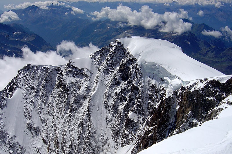
69 min walk • Signalkuppe, also known by its Italian name Punta Gnifetti, is a majestic mountain peak that soars into the skies as part of the Pennine Alps, straddling the border between Switzerland and Italy. At an impressive elevation of 4,554 meters, it is one of the highest...
 Historic mountain known for climbing
Parrotspitze
83 min walk • Ascending to the heights of the Pennine Alps, Parrotspitze stands as a majestic mountain peak in the Aosta Valley region of Italy. With an elevation of 4,432 meters, it is one of the significant summits that form the Monte Rosa Massif, a mountainous group renowned for...
 Nature, Natural attraction, Mountain
Lyskamm
115 min walk • Lyskamm, also known as Silberbast, is a towering presence in the Pennine Alps, straddling the border between Switzerland and Italy. This majestic mountain stands at an impressive height of 4,527 meters and is often referred to as one of the "four-thousanders" in the...
 Nature, Natural attraction, Mountain
Ludwigshöhe Mountain
93 min walk • Ludwigshöhe Mountain, nestled in the Pennine Alps of Italy, stands as a majestic testament to the rugged beauty of the region. At an elevation of 4,341 meters, this mountain is not only a formidable peak for mountaineers but also a breathtaking spectacle for nature...
 Nature, Natural attraction, Mountain
Vincent Pyramid
106 min walk • The Vincent Pyramid is a mountain of the Pennine Alps, located on the border between the Italian regions of Aosta Valley and Piedmont. The Vincent Pyramid makes up a large buttress of the huge multi-summited Monte Rosa. It lies south of the Ludwigshöhe on the border with...
 Nature, Natural attraction, Mountain
Corno Nero
97 min walk • The Schwarzhorn is a 4,321-metre-high summit in the Italian Alps just next to the Swiss border. It is part of the Monte Rosa massif in the Wallis Alps, which lie on the border between Switzerland and Italy.
 Nature, Natural attraction, Mountain
Western Lyskamm
125 min walk • The Western Lyskamm is a subsidiary peak of the Lyskamm.
 Soaring peak with mountain views
Nordend
62 min walk • Nordend is a northern peak of the Monte Rosa Massif. Nordend is the fourth highest peak of the massif, after the Dufourspitze, the Dunantspitze and the Grenzgipfel.
 Nature, Natural attraction, Mountain
Pizzo Bianco
39 min walk • Pizzo Bianco is a mountain of the Pennine Alps, overlooking Macugnaga in the Italian region of Piedmont. It lies on the range north of the Punta Grober, between the Belvedere Glacier and the valley of Quarazza.