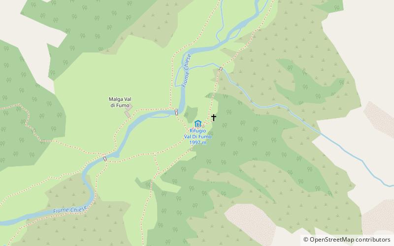
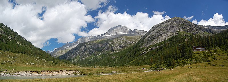
Rifugio Val Di Fumo
#5696 among destinations in Italy
![Rifugio Val Di Fumo location map](https://tzmedia.b-cdn.net/media/images/static-maps/it/46_0845_10_5625.jpg)
![Rifugio Val Di Fumo](https://tzmedia.b-cdn.net/media/images/it/place/gallery/medium/b9be8d41d0b8d71c5034003b3d25ff6c.jpg)
Facts and practical information
The Val di Fumo refuge is a refuge located in the municipality of Valdaone in the Adamello group, 1997 m above sea level.
Trentino-South TyrolItaly
Rifugio Val Di Fumo plan & book
Unleash the traveler in you — discover the cheapest flight deals, find the perfect hotel or hostel nearby, and search for the best car rental prices. Travel at your own pace to discover new places and enjoy your journey.
Rifugio Val Di Fumo – popular in the area (distance from the attraction)
Nearby attractions include: Mount Adamello, Lago di Salarno, Monte Re di Castello, Carè Alto.
5.9 miNWNature, Natural attraction, MountainMount Adamello
150 min walk • Mount Adamello is a majestic peak nestled in the heart of the Italian Alps, renowned for its imposing presence and breathtaking landscapes. At an elevation of 3,539 meters above sea level, it is one of the principal summits of the Adamello-Presanella range, which spans...
4.7 miWNature, Natural attraction, LakeLago di Salarno
119 min walk • Lago di Salarno is a lake in the Province of Brescia, Lombardy, Italy.
5.8 miSWNature, Natural attraction, MountainMonte Re di Castello
147 min walk • Monte Re di Castello is a mountain of Lombardy, Italy. It has an elevation of 2,889 metres above sea level.
2.9 miSENature, Natural attraction, MountainCarè Alto
74 min walk • Carè Alto is a mountain in the Italian Alps, near Trento, above the San Valentino valley. It has a summit elevation of 3,463 m. It is a mountain of the Adamello-Presanella Group in the provinces of Trentino and Brescia and is part of the Southern Limestone Alps.
6.1 miNWAlpine hut, HikingRifugio Serafino Gnutti
156 min walk • The Serafino Gnutti refuge is a refuge located in the municipality of Sonico, Camonica Valley, at 2166 m a.s.l. It rises in the Miller Valley, an eastern tributary of the Malga Valley, near the small lake of the same name.
3.2 miWAlpine hut, HikingRifugio Città di Lissone
81 min walk • The Città di Lissone refuge is a refuge located in the municipality of Saviore dell'Adamello, in the Camonica Valley, at 2,017 m a.s.l. Next to the refuge is an artificial reservoir that collects water from the Poia stream, while a cable car allows...
4 miNWAlpine hut, HikingRifugio Paolo Prudenzini
102 min walk • The Paolo Prudenzini refuge is a refuge located in the municipality of Saviore dell'Adamello, in the Camonica valley, at 2,235 m a.s.l. It rises at the foot of the Adamello, located at the head of the Salarno valley.
6.3 miSWAlpine hut, HikingRifugio Maria e Franco Lomini
160 min walk • The Maria and Franco refuge is a refuge located in the municipality of Ceto, Camonica Valley, at 2,574 m a.s.l. It is located at the Dernal Pass, overlooking the Dois Valley.
3.4 miNEAlpine hut, HikingRifugio Carè Alto
88 min walk • The Carè Alto "Dante Ongari" refuge is located at 2459 m a.s.l. in the Adamello group, on the long east crest of Carè Alto, a few steps from the Bus del Gat notch, on the side of the Conca valley-a side valley of Borzago.