Fleckner

Gallery (1)
Map
Map
Facts and practical information
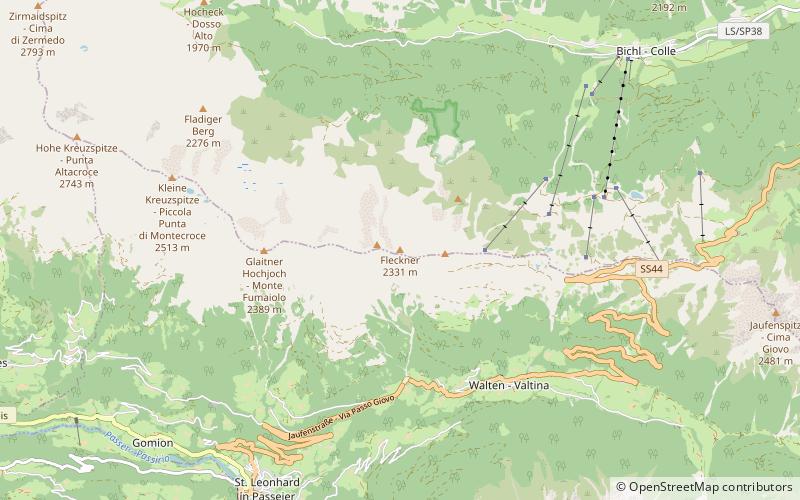
The Fleckner or Flecknerspitze is a peak of the Stubai Alps mountain range in South Tyrol, Italy. The peak has an elevation of 2331 m and on its top there is a large summit cross, which surrounded by green meadow during summer. There is hiking trail leading directly over the top and the mountain is a destination for ski tours during the winter as well. ()
Elevation: 7648 ftCoordinates: 46°50'30"N, 11°16'12"E
Location
Trentino-South Tyrol
ContactAdd
Social media
Add
Day trips


