Rifugio Val d'Ambiez - Silvio Agostini, Dolomites
#138 among attractions in Dolomites
![Rifugio Val d'Ambiez - Silvio Agostini location map](https://tzmedia.b-cdn.net/media/images/static-maps/it/46_1424_10_8695.jpg)
Facts and practical information
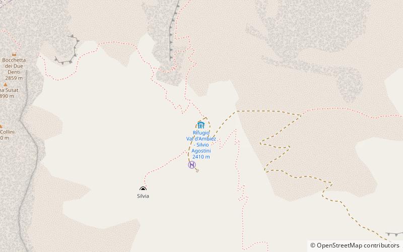
The Silvio Agostini refuge is an alpine refuge in the municipality of San Lorenzo in Banale in Val d'Ambiez, in the Brenta Dolomites in western Trentino, at 2,405 m above sea level.
Dolomites plan & book
Unleash the traveler in you — discover the cheapest flight deals, find the perfect hotel or hostel nearby, and search for the best car rental prices. Travel at your own pace to discover new places and enjoy your journey.
Rifugio Val d'Ambiez - Silvio Agostini – popular in the area (distance from the attraction)
Nearby attractions include: Cima Brenta, Lake Molveno, Campanile Basso, Cima Tosa.
3 miNENature, Natural attraction, MountainCima Brenta, Dolomites
76 min walk • Cima Brenta is the highest mountain in the Brenta group, a subgroup of the Rhaetian Alps in the Italian Region of Trentino-Alto Adige, with a reported height of 3,150 metres.
4.4 miENature, Natural attraction, LakeLake Molveno
113 min walk • Lake Molveno is a lake in Trentino, Italy. The only settlement is Molveno, located at the north end of the basin. The lake marks the boundary between the Group of the Brenta Dolomites to the west and the Paganella - Mount Gazza to the south east.
1.8 miNENature, Natural attraction, MountainCampanile Basso, Dolomites
46 min walk • Campanile Basso is a mountain in the Brenta group, a subgroup of the Rhaetian Alps in the Italian Region of Trentino-Alto Adige, with a height of. It is of a slender, almost fully vertical shape on all sides, rising 300 metres straight up.
1 miNNature, Natural attraction, MountainCima Tosa, Dolomites
25 min walk • Cima Tosa is a mountain in the Brenta group, a subgroup of the Rhaetian Alps in the Italian Region of Trentino-Alto Adige, with a reported height of 3,136 metres. it is the second highest peak of the Brenta group in the southern limestone Alps after the Cima Brenta.
3.6 miNEHiking, Alpine hutRifugio Croz dell'Altissimo, Molveno
91 min walk • The Croz dell'Altissimo refuge is a refuge located in the Brenta Dolomites, municipality of Molveno, at an altitude of 1,430 meters.
1.3 miNNature, Natural attraction, MountainCrozzon di Brenta, Dolomites
34 min walk • Crozzon di Brenta is a mountain in the Brenta Group of the Southern Limestone Alps in Trentino, Italy. It has three summits and is the most popular destination for mountaineering in the Brenta Group.
1 miN 46°9'26"N • 10°52'16"EBrenta, Dolomites
27 min walk • The Brenta Group or Brenta Dolomites is a mountain range, and a subrange of the Rhaetian Alps in the Southern Limestone Alps mountain group. They are located in the Province of Trentino, in northeastern Italy. It is the only dolomitic group west of the Adige River.
1.9 miNENature, Natural attraction, MountainCampanile Alto, Dolomites
49 min walk • Campanile Alto is a mountain in the southern Rhaetian Alps in the Brenta Dolomites.
3.9 miNENature, Natural attraction, MountainCima Falkner, Dolomites
99 min walk • CIMA Falkner - a peak in the Dolomites of Brenta, a part of the Eastern Alps. It lies in northern Italy in the Trento-Górna Adady region. The first entry in 1882 was made by A. de Falkner and Antonio Dallagiacoma.
5.1 miNENature, Natural attraction, MountainPiz Galin, Dolomites
129 min walk • Piz Galin is a 2442-meter-high mountain located in western Trentino, near the village of Andalo. It is the easternmost peak of the small subgroup of the Brenta Dolomites to which Croz dell'Altissimo also belongs.
4.3 miNNature, Natural attraction, MountainCima Grostè, Dolomites
110 min walk • Cima del Grostè - the peak in the Brenta Dolomites, belonging to the southern limestone alposes, which are part of the Eastern Alps. It lies in northern Italy in the Trento-Górna Adady region.