San Siro, Milan
Map
Facts and practical information
Address
Zona 7 (Selinunte)Milan
ContactAdd
Social media
Add
Getting there by public transportation
Public transportation stops near this location
- Metro
- Bus
- Tram
- Train
 Metro
Metro
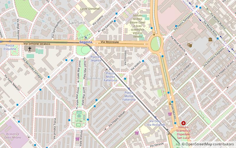
- Calculate routePiazza Monte Falterona 1 min walk
- Calculate routePiazzale Segesta 3 min walk
- Calculate routeSegesta M5 4 min walk
- Calculate routeVia Dolci - Via Ricciarelli 5 min walk
- Calculate routePiazza Monte Falterona 1 min walk
- Calculate routePiazzale Segesta 5 min walk
- Calculate routeVia Gavirate - Via Gignese 6 min walk
- Calculate routeSegesta 5 min walk
- Calculate routeLotto 10 min walk
- Calculate routeAmendola 14 min walk
- Calculate routeSan Siro Ippodromo 15 min walk
- Calculate routeMilano Nord Domodossola 30 min walk
Maps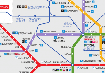 Metro
Metro
MetroDay trips


Frequently Asked Questions (FAQ)
Which popular attractions are close to San Siro?
Nearby attractions include CityLife, Milan (17 min walk), Portello, Milan (17 min walk), Leonardo's horse, Milan (18 min walk), Generali Tower, Milan (20 min walk).
How to get to San Siro by public transport?
The nearest stations to San Siro:
Tram
Bus
Metro
Train
Tram
- Piazza Monte Falterona • Lines: 16 (1 min walk)
- Piazzale Segesta • Lines: 16 (3 min walk)
Bus
- Piazza Monte Falterona • Lines: 49 (1 min walk)
- Piazzale Segesta • Lines: 98 (5 min walk)
Metro
- Segesta • Lines: M5 (5 min walk)
- Lotto • Lines: M1, M5 (10 min walk)
Train
- Milano Nord Domodossola (30 min walk)