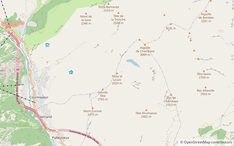
Testa di Liconi
#3868 among destinations in Italy

Facts and practical information
The Head of Liconi or Licony, is a mountain in the Grand Combin Alps located in the municipality of Courmayeur, Aosta Valley.
Aosta ValleyItaly
Testa di Liconi plan & book
Unleash the traveler in you — discover the cheapest flight deals, find the perfect hotel or hostel nearby, and search for the best car rental prices. Travel at your own pace to discover new places and enjoy your journey.
Testa di Liconi – popular in the area (distance from the attraction)
Nearby attractions include: Torino Hut, Pointe Helbronner, Tour du Mont Blanc, Rifugio Giorgio Bertone vecchio.
 Hiking, Alpine hut
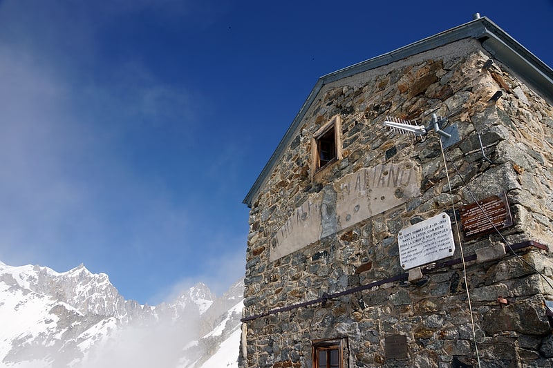
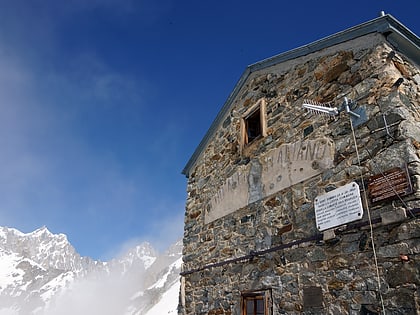
Torino Hut, Courmayeur
134 min walk • Nestled in the heart of the Italian Alps, the Torino Hut is a mountain cabin that serves as a haven for climbers and adventurers seeking to explore the majestic peaks surrounding Courmayeur, Italy. This refuge, set at an altitude of 3,375 meters, offers a unique...
 Alpine summit accessed by cable car
Pointe Helbronner
137 min walk • Pointe Helbronner is a soaring pinnacle that commands the skies between France and Italy, situated within the majestic Mont Blanc massif. Rising to an elevation of 3,462 meters, this mountain is a haven for alpine enthusiasts and a jewel in the crown of the European...
 Hiking, Hiking trail
Tour du Mont Blanc, Courmayeur
69 min walk • The Tour du Mont Blanc or TMB is one of the most popular long-distance walks in Europe. It circles the Mont Blanc massif, covering a distance of roughly 170 kilometres with 10 kilometres of ascent/descent and passing through parts of Switzerland, Italy and France.
 Hiking, Alpine hut
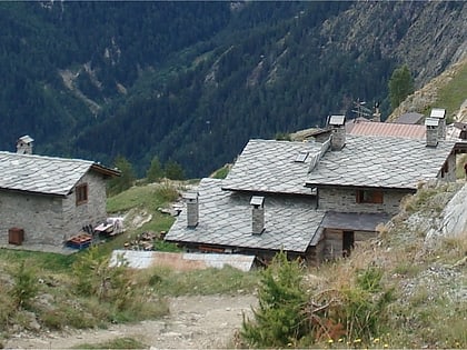
Rifugio Giorgio Bertone vecchio, Courmayeur
54 min walk • The Giorgio Bertone refuge is located in the Aosta Valley in the Pennine Alps in the municipality of Courmayeur.
 Hiking, Alpine hut
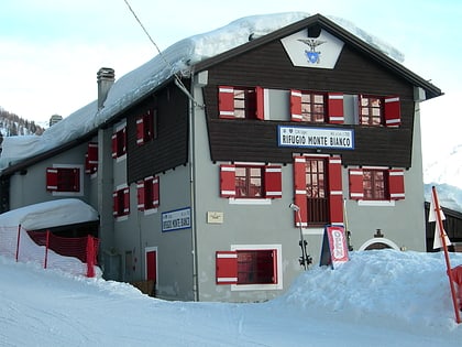
Rifugio Monte Bianco
109 min walk • Refuge Mont-Blanc is a low-altitude refuge in the Alps in Val Veny, near Courmayeur, Italy.
 Nature, Natural attraction, Mountain
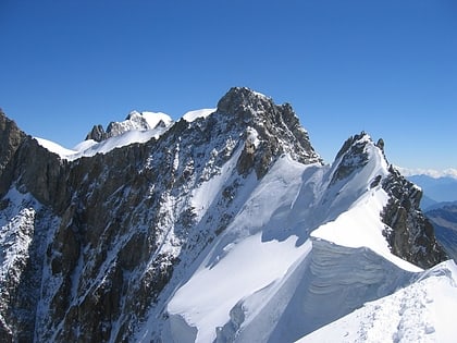
Aiguille de Rochefort
135 min walk • The Aiguille de Rochefort is a mountain in the Mont Blanc massif in France and Italy. The peak lies on the Rochefort arête between the Dent du Géant and the Grandes Jorasses and is usually climbed during a traverse of the ridge.
 Church
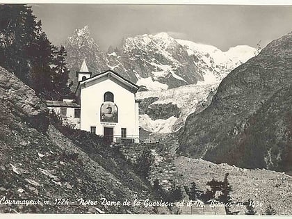
Notre Dame de Guérison sanctuary, Courmayeur
92 min walk • Notre-Dame de Guérison is a Christian sanctuary situated in Courmayeur, at the foot of Mont Chétif, along the Val Veny road that leads to the Seigne pass, also known as the "Cremonis Iugum", used by the Romans to reach Gaul.
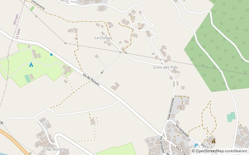 Valley
Valdigne, La Salle
102 min walk • The Valdigne is the upper part of the Aosta Valley in north-west Italy. It is traversed by the Dora Baltea, a tributary of the Po.
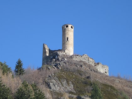 Forts and castles
Châtelard Castle
89 min walk • Châtelard Castle is a medieval castle in the town of La Salle in the Aosta Valley region of Italy. The castle is believed to have been built by Rodolphe Grossi, who was Bishop of Aosta from 1243.
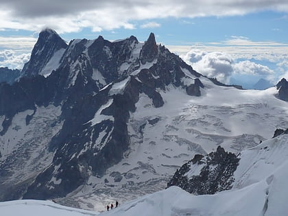 Nature, Natural attraction, Mountain
Dôme de Rochefort
135 min walk • The Dôme de Rochefort is a mountain in the Mont Blanc massif in Haute-Savoie, France and of Aosta Valley, Italy.
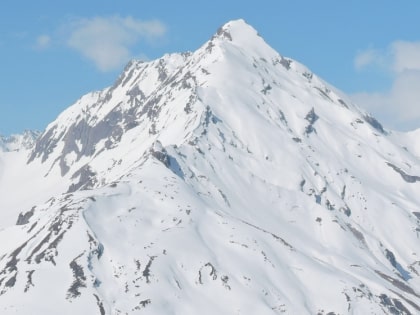 Nature, Natural attraction, Mountain
Grande Rochère
60 min walk • The Grande Rochère is a mountain of the Italian Pennine Alps, located north of Morgex in the Aosta Valley. Reaching a height of 3,326 metres above sea level, it is the culminating point of the group lying between the Col Ferret and the Great St. Bernard Pass.