Birkenkopf, Stuttgart


Facts and practical information
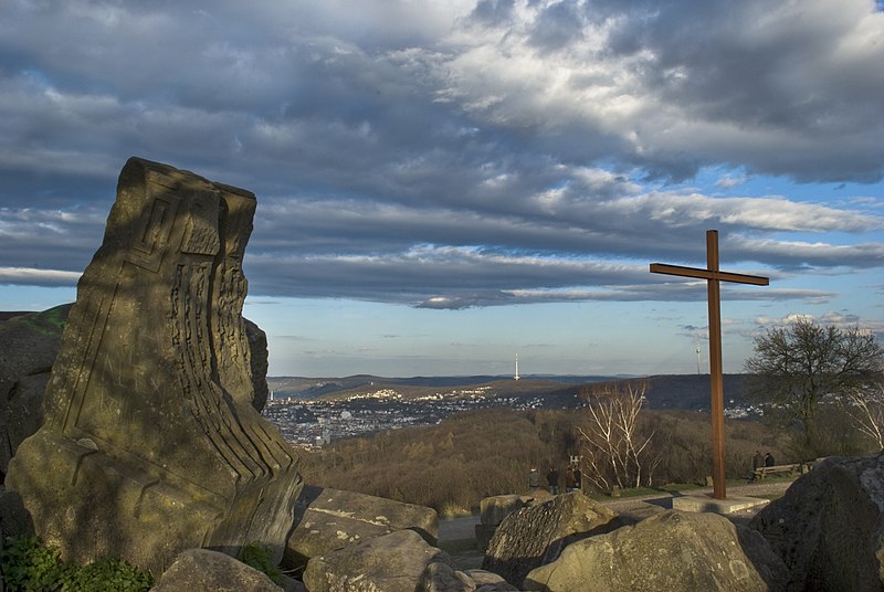
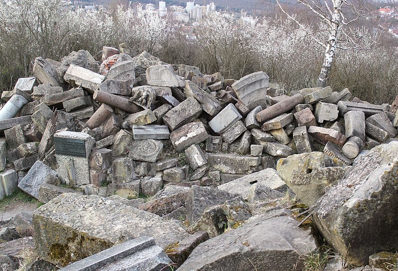
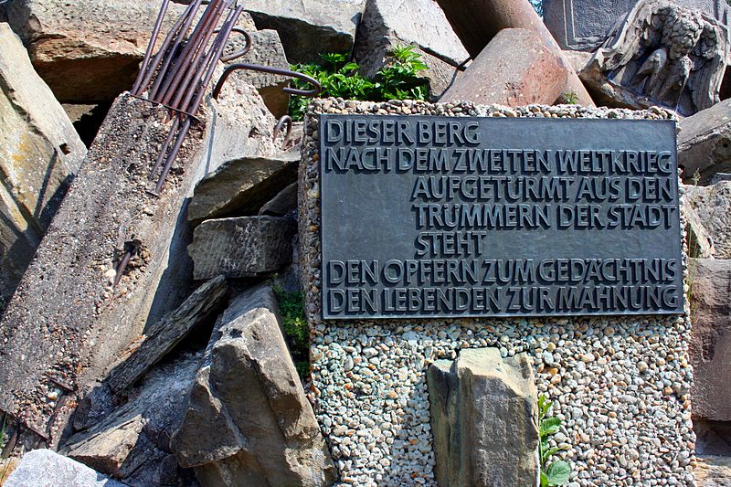
Rising above the urban landscape of Stuttgart, Germany, the Birkenkopf is a poignant testament to history and a place of reflection. Known also as "Monte Scherbelino," which loosely translates to "Mount Shards," this 511-meter high hill is not a natural formation but rather a mound composed of the ruins and rubble from buildings destroyed during World War II.
Constructed between 1953 and 1957, the Birkenkopf was created by piling up the remnants of the war to both clear the city for reconstruction and to serve as a memorial to the victims. Approximately 1.5 million cubic meters of debris were used to increase the hill's height by around 40 meters, making it the highest point in Stuttgart's inner city.
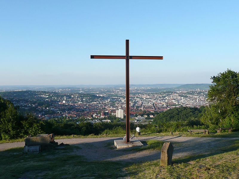
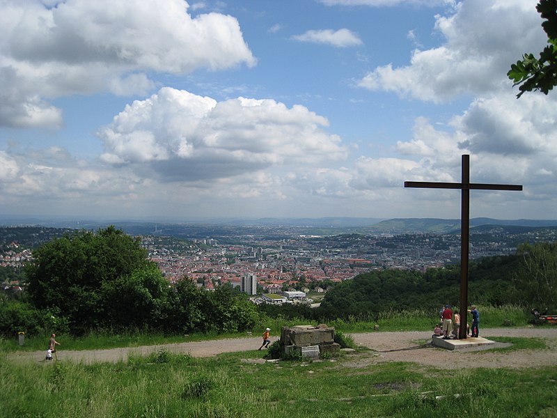
Today, the Birkenkopf stands as a somber reminder of the devastation of war. Visitors who trek to the summit are met with a panoramic view of Stuttgart, juxtaposed against the visible remnants of walls, staircases, and foundations that protrude from the ground – silent witnesses to the city's turbulent past.
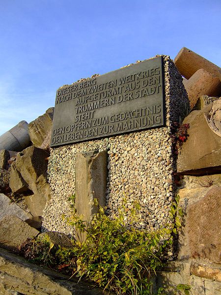
An informational plaque at the summit provides historical context, and the site often evokes a sense of contemplation and remembrance for those who visit. The climb to the top can be somewhat steep, but the path is well-maintained and accessible for most visitors.
The Birkenkopf is not only a popular destination for those interested in history but also for hikers and nature enthusiasts seeking a tranquil escape and a unique vantage point to view the cityscape. Despite its somber origins, the site has been reclaimed by nature, with trees and vegetation covering much of the hillside.
- Bus
- Light rail
- Train
 Bus
Bus
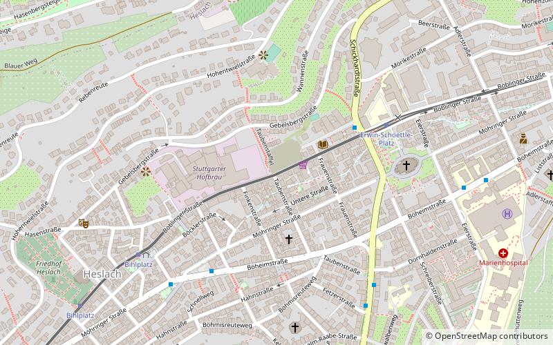
- Calculate routeBirkenkopf 4 min walk
- Calculate routeTennisplatz 10 min walk
- Calculate routeRudolf-Sophien-Stift 16 min walk
- Calculate routeLindpaintnerstraße 17 min walk
- Calculate routeHerderplatz 17 min walk
- Calculate routeSüdheimer Platz 19 min walk
- Calculate routeHeslach Vogelrain 21 min walk
- Calculate routeStuttgart Schwabstraße 30 min walk


Frequently Asked Questions (FAQ)
Which popular attractions are close to Birkenkopf?
How to get to Birkenkopf by public transport?
Bus
- Birkenkopf • Lines: 92 (4 min walk)
- Tennisplatz • Lines: 92 (10 min walk)
Light rail
- Lindpaintnerstraße • Lines: U2, U29 (17 min walk)
- Herderplatz • Lines: U2, U29 (17 min walk)
Train
- Stuttgart Schwabstraße (30 min walk)