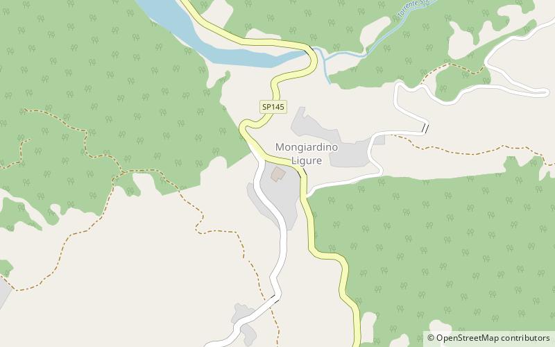
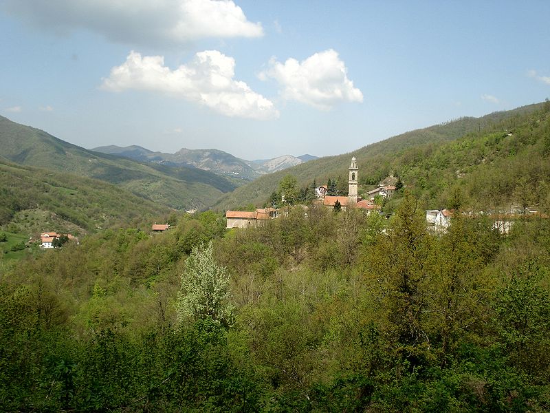
Mongiardino Ligure
#3235 among destinations in Italy
![Mongiardino Ligure location map](https://tzmedia.b-cdn.net/media/images/static-maps/it/44_6397_9_06096.jpg)
![Mongiardino Ligure](https://tzmedia.b-cdn.net/media/images/it/place/gallery/medium/39a273facca9251af2062bba5516fbff.jpg)
Facts and practical information
PiedmontItaly
Mongiardino Ligure plan & book
Unleash the traveler in you — discover the cheapest flight deals, find the perfect hotel or hostel nearby, and search for the best car rental prices. Travel at your own pace to discover new places and enjoy your journey.
Mongiardino Ligure – popular in the area (distance from the attraction)
Nearby attractions include: Monte Antola, Monte Buio, Monte delle Tre Croci, Valico di San Fermo.
6.3 miSENature, Natural attraction, MountainMonte Antola
161 min walk • Nestled in the heart of the Ligurian Apennines in Italy, Monte Antola is a mountain that offers a tranquil escape from the bustling cities. Standing at an elevation of 1,597 meters, it is a popular destination for hikers and nature enthusiasts seeking to immerse...
4.7 miSENature, Natural attraction, MountainMonte Buio
120 min walk • Monte Buio is a mountain in Liguria, northern Italy, part of the Ligurian Appennines. It is located between the provinces of Genoa and Alessandria. It lies at an altitude of 1400 metres.
6.6 miSENature, Natural attraction, MountainMonte delle Tre Croci
168 min walk • Monte delle Tre Croci is a mountain on the border between Liguria and Piedmont, northern Italy, part of the Ligurian Appennines. It has a summit elevation of 1,565 metres.
2.9 miSENature, Natural attraction, Mountain passValico di San Fermo
75 min walk • Valico di San Fermo also called Valico di San Clemente is a mountain pass between province of Genoa and province of Alessandria in Italy. It connects the Borbera and Vobbia valley, linking Cabella Ligure and Vobbia in the south.
4.9 miSNature, Natural attraction, MountainRocche del Reopasso, Crocefieschi
125 min walk • Rocche del Reopasso is a mountain in Liguria, northern Italy, part of the Ligurian Appennines.
4.5 miWNature, Natural attraction, MountainMonte Reale
116 min walk • Monte Reale is a mountain of the Ligurian Apennines. It is located in the Province of Genoa along the watershed between the basin of the Scrivia Torrent and that of the Vobbia, its tributary to the right.
2.9 miSWForts and castlesCastello della Pietra, Vobbia
73 min walk • The Stone Castle is an ancient fortification located in the Ligurian municipality of Vobbia, situated in the valley of the same name tributary to the Scrivia stream. It is the main and most characteristic monument of the Genoa hinterland, a...
1.5 miWNature, Natural attraction, MountainBric delle Camere
38 min walk • Bric delle Camere is a mountain in northern Italy, part of the Ligurian Appennines. It is located in the provinces of Genoa and Alessandria. It lies at an altitude of 1016 metres.
6.9 miSWChurchSt. George Church, Busalla
176 min walk • The church of San Giorgio is a Catholic place of worship located in the hamlet of Sarissola, Via alla Chiesa, in the municipality of Busalla in the metropolitan city of Genoa. The church is the seat of the parish of the same name of the Genovesato...
2.1 miSENature, Natural attraction, MountainMonte Castello
55 min walk • Monte Castello is a mountain in Liguria, northern Italy, part of the Ligurian Appennines. It is located in the provinces of Genoa and Alessandria. It lies at an altitude of 1092 metres.
2.9 miWForts and castlesCastello degli Spinola di Montessoro
75 min walk • Montessoro Castle is an ancient ruined fortification in the eponymous locality of Isola del Cantone, in the metropolitan city of Genoa; it was the noble residence of the Spinola family.