Lago di Gramolazzo, Minucciano
#1 among attractions in Minucciano
![Lago di Gramolazzo location map](https://tzmedia.b-cdn.net/media/images/static-maps/it/44_1643_10_2515.jpg)
Facts and practical information
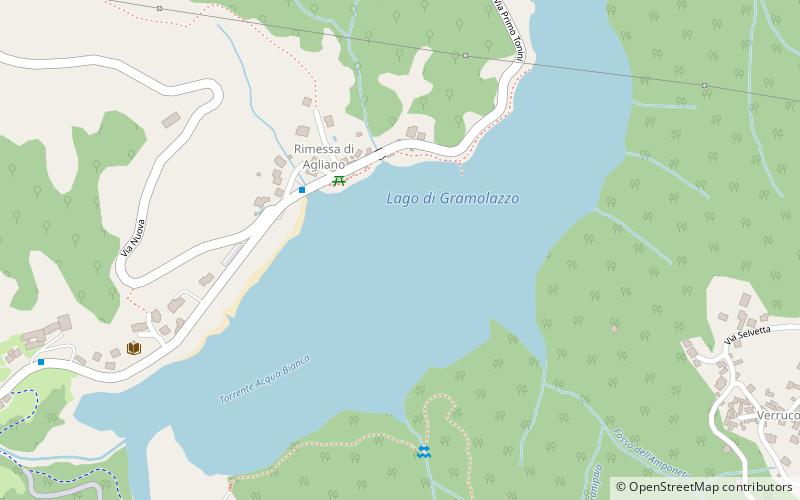
Lago di Gramolazzo is a lake in the Province of Lucca, Tuscany, Italy. At an elevation of 604 m, its surface area is 1 km². ()
Via Tonini 211Minucciano 55034 Italy
Minucciano plan & book
Unleash the traveler in you — discover the cheapest flight deals, find the perfect hotel or hostel nearby, and search for the best car rental prices. Travel at your own pace to discover new places and enjoy your journey.
Lago di Gramolazzo – popular in the area (distance from the attraction)
Nearby attractions include: Verrucole Castle, Lago di Vagli, Monte Pisanino, Santa Maria Assunta Church.
4.1 miEForts and castles, Historical placeVerrucole Castle
106 min walk • Perched atop a hill in the serene Garfagnana region of Tuscany, Italy, the Verrucole Castle is a testament to medieval military architecture. This formidable fortress, whose origins date back to the 11th century, offers a glimpse into the past with its well-preserved...
4.1 miSENature, Natural attraction, LakeLago di Vagli, Vagli Sotto
104 min walk • Lago di Vagli is a lake in the Province of Lucca, Tuscany, Italy. It was created in 1953 after the construction of a dam. It houses a depopulated village, the Fabbriche di Careggine, which becomes reachable when the basin is emptied for maintenance.
2.8 miSWNature, Natural attraction, MountainMonte Pisanino
72 min walk • Monte Pisanino is the highest peak in the Alpi Apuane, in Tuscany, central Italy. Located in the comune of Minucciano, it is also the highest mountain entirely belonging to the Tuscany region.
4.3 miNEChurchSanta Maria Assunta Church
111 min walk • Santa Maria Assunta is a 12th-century Roman Catholic church building in the frazione of Borsigliana in the town limits of Piazza al Serchio, province of Lucca, region of Tuscany, Italy.
4.1 miSNature, Natural attraction, MountainMonte Tambura
105 min walk • Monte Tambura is a mountain in the Alpi Apuane, in Tuscany, central Italy. It is the second highest peak in the chain after Monte Pisanino.
4.5 miNWChurchChiesa di Santa Felicita, Casola in Lunigiana
115 min walk • The church of Santa Felicita is a sacred building located in Casola in Lunigiana. The church is first recorded in 1296-97, and to that phase belongs the Romanesque wall face of squared sandstone blocks on the left flank.
4.9 miWNatural attraction, Park, Theme parkLe Grotte di Equi Terme
125 min walk • Equi Terme is a part of the Italian comune Fivizzano, in the province of Massa and Carrara, in Tuscany.
4.1 miEChurchChiesa di San Jacopo, Camporgiano
105 min walk • The church of San Iacopo or Giacomo is a sacred building located in Camporgiano.
3.4 miWChurchChurch of Sant'Andrea
87 min walk • The church of St. Andrew is a sacred building located in the village of Ugliancaldo in Casola in Lunigiana.
5.3 miWChurchPieve di Codiponte
137 min walk • The parish church of Saints Cornelius and Cyprian in Codiponte is a sacred building located in Codiponte, in the municipality of Casola in Lunigiana.
4.1 miEBotanical gardenOrto Botanico "Pania di Corfino"
106 min walk • The Giardino Botanico "Maria Ansaldi" Pania di Corfino is a botanical garden located an altitude of 1370 m in the Appennino Tosco-Emiliano National Park, near the visitor center of Orecchiella Natural Park in Isera, Corfino, Villa Collemandina, Province of Lucca, Tuscany, Italy.