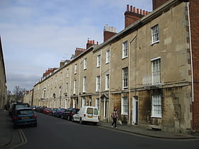
Oxford: Street
Places and attractions in the Street category
Categories
- Park
- Universities and schools
- Street
- Church
- Shopping
- Shopping district
- Museum
- Bridge
- Historical place
- Library
- Architecture
- Gothic Revival architecture
- Nightlife
- History museum
- Theater
- Square
- Shopping centre
- Concerts and shows
- J. R. R. Tolkien
- Garden
- Sacred and religious sites
- Sport
- Sport venue
- Specialty museum
- Cemetery
- Memorial
- Gothic architecture
- Art museum
- Monastery
- Natural attraction
- Nature
- Hill
- Neighbourhood
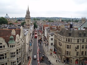
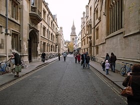
High Street
High Street, commonly referred to as the "High," is a bustling artery of commerce and history in the heart of Oxford, United Kingdom. This iconic street is renowned for its vibrant shopping district, offering a harmonious blend of traditional boutiques, modern...
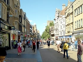
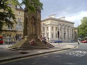
Cornmarket Street
Nestled in the heart of Oxford, United Kingdom, Cornmarket Street is a bustling shopping district steeped in history and brimming with contemporary charm. Known colloquially as 'Cornmarket,' this pedestrianized thoroughfare offers a blend of high-street favorites...
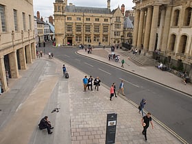
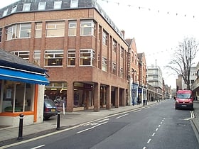
Broad Street
Broad Street in Oxford, United Kingdom, is more than just a thoroughfare; it is a historic and cultural hub that offers a unique shopping experience amidst the city's prestigious academic backdrop. Known for its blend of architectural beauty and retail charm, Broad...
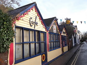
Queen Street
Queen Street in Oxford, United Kingdom, is a bustling shopping district nestled in the heart of this historic city. Known for its vibrant atmosphere and diverse array of shops, Queen Street is a prime destination for both locals and tourists looking to indulge in...
Turl Street
Nestled in the heart of the historic city of Oxford, Turl Street is a charming and vibrant shopping district that offers a unique blend of traditional and contemporary retail experiences. This narrow, cobblestoned street is lined with an eclectic array of independent...
Magdalen Street
Nestled in the heart of the historic city of Oxford, Magdalen Street emerges as a vibrant shopping district that offers a unique blend of traditional charm and contemporary retail. This bustling thoroughfare provides locals and tourists alike with an eclectic shopping...
Little Clarendon Street
Tucked away in the heart of Oxford, Little Clarendon Street is a charming and vibrant shopping district that captures the essence of the city's unique blend of historic character and contemporary living. Known affectionately by locals as "Little Clary," this quaint...
North Parade
Nestled in the heart of the historic city of Oxford, North Parade is a charming shopping district that offers a unique blend of traditional and contemporary retail experiences. This quaint street, lined with independent shops and boutiques, presents an inviting...
George Street
George Street in Oxford, United Kingdom, is a vibrant and bustling shopping district nestled in the heart of this historical city. Known for its diverse range of shops, eateries, and entertainment venues, George Street offers a contemporary contrast to the ancient...
New Inn Hall Street
Nestled in the heart of Oxford, United Kingdom, New Inn Hall Street is a bustling shopping district that offers a unique blend of historical charm and contemporary retail. Known for its vibrant atmosphere and diverse range of shops, this street is a must-visit...
Park End Street
Park End Street in Oxford is not just an ordinary street – it's the bustling commercial heart of the city, vibrant with life both day and night. This lively shopping district is a favorite shopping destination for locals, Oxford University students, and tourists from...
Walton Well Road
Walton Well Road is a road, about 400 metres long, near the centre of Oxford, England. It provides a link from central Oxford to Port Meadow.
St Aldate's
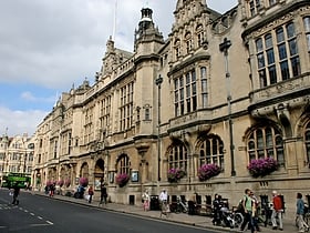
St Aldate's is a street in central Oxford, England, named after Saint Aldate, but formerly known as Fish Street. The street runs south from the generally acknowledged centre of Oxford at Carfax. The Town Hall, which includes the Museum of Oxford, is on the east side of the street.
Longwall Street
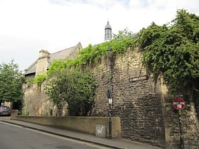
Longwall Street is a street in central Oxford, England. It runs for about 300 metres along the western flank of Magdalen College. A high, imposing 15th century stone wall separates the college from the street along its entire length. Behind part of the wall is the college's deer park.
Holywell Street
Holywell Street is a street in central Oxford, England. It runs east-west with Broad Street to the west and Longwall Street to the east. About halfway along, Mansfield Road adjoins to the north. New College dominates the south side of the street.
Holywell Music Room
Holywell Street is a street in central Oxford, England. It runs east-west with Broad Street to the west and Longwall Street to the east. About halfway along, Mansfield Road adjoins to the north. New College dominates the south side of the street.
Mill Street
Mill Street is a street in Oxford, England. It is a cul-de-sac that runs south from the Botley Road close to Oxford railway station. It includes residential houses, mainly terraced, and some office space. Mill Street was built in the 1860s as part of the development of New Osney on what was then known as Osney Island.
South Parade
South Parade is a shopping street in Summertown, north Oxford, England. It runs between Woodstock Road to the west and Banbury Road to the east, where there are also shops stretching south from South Parade.
Aristotle Lane
Aristotle Lane is a road in north Oxford, England. The lane links North Oxford, leading from the junction of Kingston Road and Hayfield Road, with Port Meadow to the west, via bridges over the Oxford Canal and railway.
Oxpens Road
Oxpens Road is a road in central Oxford, England, linking west and south Oxford. It is named after the marshy area of Oxpens, next to one of the branches of the River Thames in Oxford. It forms part of the A420 road.
Paradise Street
Paradise Street is a historical street in central Oxford, England. It is in the St Ebbe's area of Oxford, to the southwest of Oxford Castle. The street runs from Paradise Square to Quaking Bridge, across Castle Mill Stream. It continues to the east into Castle Street. Historically, both Greyfriars and Blackfriars lived here.
Castle Street
Castle Street is a street in Oxford, England. It is named after Oxford Castle which is close by to the west and is located in the St Ebbe's area of southwest central Oxford. "Castell Streate" can be found on a map of 1578 by Ralph Agas. In 1885, Castle Terrace was built by F. J. Codd in the adjoining Paradise Street.
South Parks Road
South Parks Road is a road in Oxford, England. It runs east–west past the main Science Area of the University of Oxford. Many of the university science departments are located nearby or face the road, including parts of the geography, zoology, chemistry, psychology and physiology departments.
Lonsdale Road
Lonsdale Road is a residential road in Summertown, north Oxford, England. The road runs between Banbury Road to the west and the River Cherwell to the east. To the south is Summer Fields School, a private preparatory school.
Polstead Road
Polstead Road is a residential road that runs between Kingston Road and Hayfield Road to the west and the Woodstock Road to the east, in the suburb of North Oxford, England. Halfway along it forms the southern junction of Chalfont Road. The road is probably named after the village of Polstead in the county of Suffolk.
Magpie Lane
Magpie Lane is a narrow historic lane in central Oxford, England. It leads south from the High Street where it is at its narrowest, now completely pedestrianised as a pavement, and north from the cobbled Merton Street.
Logic Lane
Logic Lane is a small historic cobbled lane that runs through University College in Oxford, England, so called because it was the location of a school of logicians.
St Michael's Street
St Michael's Street is a street in central Oxford, England. It runs between New Inn Hall Street to the west and Cornmarket to the east, with Ship Street almost opposite. Northgate Hall is located here. Also to be found off the street is the debating chamber of the Oxford Union, a leading student society in the University of Oxford.
St. Ebbes
St Ebbes is a district of central Oxford, England, southwest of Carfax. St Ebbes Street runs south from the western end of Queen Street.
Rewley Road
Rewley Road is in the west of central Oxford, England. It is located in St Thomas's parish.
King Edward Street
King Edward Street is a street running between the High Street to the north and Oriel Square to the south in central Oxford, England. To the east is the "Island" site of Oriel College, one of the colleges of Oxford University.
Bardwell Road
Bardwell Road is a road in North Oxford, England, off the Banbury Road. The road is the location of the Dragon School, a well-known preparatory school.
Brasenose Lane
Brasenose Lane runs east–west in central Oxford, England, between Turl Street and Radcliffe Square respectively. From Turl Street it is only accessible to pedestrians, but vehicles can enter from Radcliffe Square.
Pusey Street
Pusey Street links the wide thoroughfare of St Giles' Street to the east with St John Street to the west in the St John Street area of central Oxford, England.
Kingston Road
Kingston Road is a road in Oxford, England. It continues north from Walton Street, at the junction with Walton Well Road to the west and St Bernard's Road to the east, running parallel with and to the west of Woodstock Road. Kingston Road is the main road in Walton Manor.
Fyfield Road
Fyfield Road is a residential road in North Oxford, England, on the Norham Manor estate. At the northern end of the road is a junction with Norham Road and at the southern end is a junction with Norham Gardens, was the University Parks opposite.
Headington Road
Headington Road is an arterial road in the east of Oxford, England. The road connects the junction of St Clements and Marston Road with the suburb of Headington, up Headington Hill.
Hayfield Road
Hayfield Road is a residential road that runs north-south in Walton Manor, north Oxford, England.
Bevington Road
Bevington Road is a residential road in central North Oxford, England. The road runs between Woodstock Road to the west and Banbury Road to the east. Winchester Road leads north from halfway along Bevington Road. The road was previously known as Horse and Jockey Road.
Lathbury Road
Lathbury Road is a short residential road in north Oxford, England. The road runs approximately east–west with a small curve halfway along.
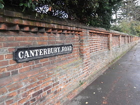
Canterbury Road
Canterbury Road is a road in North Oxford, England. It runs between Woodstock Road to the west and Banbury Road to the east. Winchester Road leads south from halfway along Canterbury Road, linking with Bevington Road that runs parallel to the south. Also to the south are North Parade and Church Walk.
New College Lane
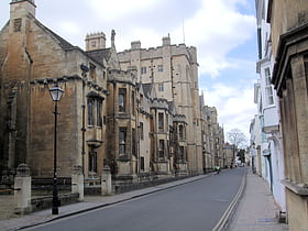
New College Lane is a historic street in central Oxford, England, named after New College, one of the older Oxford colleges, adjacent to the north.
Blackhall Road
Blackhall Road is a road running between Keble Road to the north and Museum Road to the south in central Oxford, England, dating from the late 19th century. It is named after Black Hall, dating from at least 1519, fronting onto St Giles', and now part of St John's College.
St John Street
St John Street is a street in central Oxford, England. The street mainly consists of Georgian-style stone-faced Grade II listed terraced houses. It was built as a speculative development by St John's College starting in the 1820s and finishing in the 1840s at the start of the Victorian era.
Map

