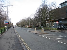
Cambridge: Street
Places and attractions in the Street category
Categories
- Universities and schools
- Historical place
- Church
- Park
- Shopping
- Museum
- Bridge
- Gothic Revival architecture
- Sacred and religious sites
- Nightlife
- Street
- Shopping district
- Science museum
- Specialty museum
- Concerts and shows
- Art museum
- Library
- History museum
- Theater
- Cemetery
- Sport
- Sport venue
- Monastery
St John's Street
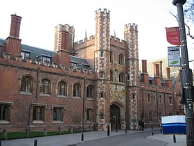
St John's Street is a historical street in central Cambridge, England. The street links with Bridge Street, Round Church Street, and Sidney Street to the north. It continues to the south as Trinity Street, then King's Parade and Trumpington Street.
Trinity Street
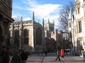
Trinity Street is a street in central Cambridge, England. The street continues north as St John's Street, and south as King's Parade and then Trumpington Street. The street is named after Trinity College, which is on its west side. Also on the street, just to the south, is Gonville and Caius College.
Jesus College
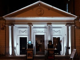
Jesus Lane is a street in central Cambridge, England. The street links with the junction of Bridge Street and Sidney Street to the west. To the east is a roundabout. To the south is King Street, running parallel with Jesus Lane and linking at the roundabout.
King's Parade
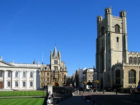
King's Parade is a street in central Cambridge, England. The street continues north as Trinity Street and then St John's Street, and south as Trumpington Street.
Gonville Place
Gonville Place is a road in southeast central Cambridge, England. It forms part of the city's inner ring road. At the southwest end is the junction of Regent Street and Hills Road, where the road continues as Lensfield Road.
King Street
King Street is a street in central Cambridge, England. It connects between Sussex Street heading west and Hobson Street heading south at the western end and a large roundabout to the east. It runs parallel to and south of Jesus Lane. The roads link together at a roundabout at the eastern end.
Regent Street
Regent Street is an arterial street in southeast central Cambridge, England. It runs between St Andrew's Street, at the junction with Park Terrace, to the northwest and Hills Road at the junction with the A603 to the southeast.
West Road
West Road is located in western Cambridge, England. It links Grange Road to the west with Queen's Road to the east. The road is north of Sidgwick Avenue and the Sidgwick Site, a major site of the University of Cambridge, currently under redevelopment.
Magdalene Street
Magdalene Street is a street in the north of central Cambridge, England. It runs between Castle Street, by Castle Hill, at the junction with Northampton Street and Chesterton Lane, then Chesterton Road, to the northwest and Bridge Street at the junction with Thompson's Lane to the southeast.
Peas Hill
Peas Hill is a street in central Cambridge, England. It runs between Wheeler Street to the south and Market Hill to the north. King's Parade runs parallel with the street to the west. Guildhall Street runs parallel to the east.
St Edward's Passage
St Edward's Passage, known in the 18th century as Chain Lane, is a Y-shaped alleyway in Cambridge, England, between King's Parade—opposite the main gate of King's College—and Peas Hill. It houses the entrance and churchyard of the Church of St Edward King and Martyr; the Cambridge Arts Theatre; several cottages; G.
Sedley Taylor Road
Sedley Taylor Road is a road in west Cambridge, England. It is reputedly one of the most expensive in the UK and the most expensive in East Anglia. The road was built on land owned by Trinity College and named after one of its professors, Sedley Taylor.
Sidgwick Avenue
Sidgwick Avenue is a road located in western Cambridge, England. The avenue runs east-west and links Grange Road to the west with Queen's Road to the east. The line of the road continues northeast into central Cambridge as Silver Street.
Trumpington Street
Trumpington Street is a major historic street in central Cambridge, England. At the north end it continues as King's Parade where King's College is located.
Queen's Road
Queen's Road is a major road to the west of central Cambridge, England. It links with Madingley Road and Northampton Street to the north with Sidgwick Avenue, Newnham Road and Silver Street to the south.
Trinity Lane
Trinity Lane is a street in the centre of Cambridge, England. The lane leads off Trinity Street. At the entrance to the lane from Trinity Street as it leads west, Trinity College is located on the north side of the lane, including Nevile's Gate, and Gonville and Caius College is on the south side.
Mill Road
Mill Road is a street in southeast Cambridge, England. It runs southeast from near to Parker's Piece, at the junction with Gonville Place, East Road, and Parkside. It crosses the main railway line and links to the city's ring road.
Bridge Street
Bridge Street is a historic street in the north of central Cambridge, England. It runs between Magdalene Street at the junction with Thompson's Lane to the northwest and Sidney Street at the junction with Jesus Lane to the southeast.
Station Road
Station Road is a road in southeast Cambridge, England. It leads from a junction with traffic lights on Hills Road to the Cambridge railway station. At the western end of Station Road on the opposite side of Hills Road is the Cambridge University Botanic Garden.
Silver Street
Silver Street is located in the southwest of central Cambridge, England. It links Queen's Road to the west with Trumpington Street to the east. The road continues west out of central Cambridge as Sidgwick Avenue.
Tennis Court Road
Tennis Court Road is a street in central Cambridge, England. It runs parallel with Trumpington Street to the west and Regent Street to the east. At the northern end is a junction with Pembroke Street to the west and Downing Street to the east. To the south as a T-junction with Lensfield Road.
St Mary's Street
St Mary's Street is a historic street in the centre of the University area in Cambridge, England.
Lensfield Road
Lensfield Road is a road in southeast central Cambridge, England. It runs between the junction of Trumpington Street and Trumpington Road to the west and the junction of Regent Street and Hills Road to the west.
Covent Garden
Covent Garden is a street in Cambridge, England, off Mill Road and near The Kite district. The street takes its name from the London market of the same name as there used to be a market garden there.
Northampton Street
Northampton Street is a street in the north of central Cambridge, England. It runs between Madingley Road and Queen's Road to the west and Castle Street, by Castle Hill, Chesterton Lane, and Magdalene Street to the east.
Pembroke Street
Pembroke Street is a street in central Cambridge, England. It runs between Downing Street and Tennis Court Road at the eastern end and a junction with Trumpington Street at the western end.
Grange Road
Grange Road is a street in Cambridge, England. It stretches north–south, meeting Madingley Road at a T-junction to the north and Barton Road to the south. It runs approximately parallel with the River Cam to the east. Grange Road is almost one mile long and has 17th century origins.
Storey's Way
Storey's Way is a mainly residential road, approximately 650 metres to the west of the city centre in Cambridge, England. It falls within the Castle Electoral Ward of Cambridge City Council, and feeds on to the major arterial roads Huntingdon Road to the north and Madingley Road to the west.
Free School Lane
Free School Lane is a historic street in central Cambridge, England which includes important buildings of University of Cambridge.
Corn Exchange Street
Corn Exchange Street is a street in central Cambridge, England. It runs between Wheeler Street to the northwest and Downing Street to the southeast.
Guildhall Street
Guildhall Street is a street in central Cambridge, England. To the north is the southeast corner of Market Hill at the junction with the pedestrianised shopping street Petty Cury. To the south it continues as Guildhall Place, a cul-de-sac, at the junction with Wheeler Street, close to the northern end of Corn Exchange Street.
Bene't Street
Bene't Street is a short, historic street in central Cambridge, England, the name being derived from St Benedict. There is a junction with King's Parade to the north and Trumpington Street to the south at the western end of the street.
Wheeler Street
Wheeler Street is a street in central Cambridge, England. It runs between Bene't Street to the southwest and Guildhall Street and Corn Exchange Street to the northeast.
Downing Street
Downing Street is a street in central Cambridge, England. It runs between Pembroke Street and Tennis Court Road at the western end and a T-junction with St Andrew's Street at the eastern end. Corn Exchange Street and St Tibbs Row lead off to the north. Downing Place leads off to the south.
Map

