Omaha: Neighbourhood
Places and attractions in the Neighbourhood category
Categories
- Park
- Museum
- Church
- Shopping
- History museum
- Theater
- Concerts and shows
- Historical place
- Cemetery
- Golf
- Bridge
- Nightlife
- Sport
- Sport venue
- Art gallery
- Neo-renaissance architecture
- Library
- Romanesque architecture
- Playground
- Neighbourhood
- Street

North Omaha
North Omaha is a community area in Omaha, Nebraska, in the United States. It is bordered by Cuming and Dodge Streets on the south, Interstate 680 on the north, North 72nd Street on the west and the Missouri River and Carter Lake, Iowa on the east, as defined by the University of Nebraska at Omaha and the Omaha Chamber of Commerce.

Gold Coast Historic District
The Gold Coast Historic District is located in Midtown Omaha, Nebraska. Listed on the National Register of Historic Places in 1997, this historic district covers approximately a 30 block area roughly bounded by 36th, 40th, Jones, and Cuming Streets.
South Omaha
South Omaha is a former city and current district of Omaha, Nebraska, United States. During its initial development phase the town's nickname was "The Magic City" because of the seemingly overnight growth, due to the rapid development of the Union Stockyards.

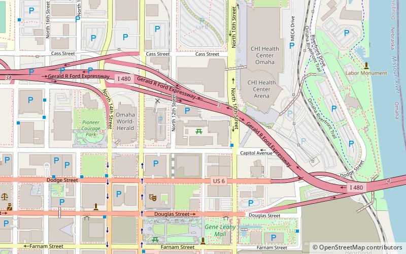
Downtown Omaha
Downtown Omaha is the central business, government and social core of the Omaha-Council Bluffs metropolitan area, U.S. state of Nebraska.

Bemis Park Landmark Heritage District
The Bemis Park Landmark Heritage District is located in North Omaha, Nebraska. Situated from Cuming Street to Hawthorne Avenue, Glenwood Avenue to 33rd Street, Bemis Park was annexed into Omaha in 1887, and developed from 1889-1922. The district was designated an Omaha Landmark in 1983.
Burnt District
The Burnt District was the original red light district in Omaha, Nebraska in the late 19th century. The area was located east of Creighton University from Douglas Street six blocks north to Cass Street and from the Missouri River west to Sixteenth Street, centered around the area currently containing Pioneer Courage Park.
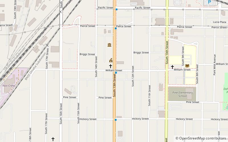
Little Bohemia
Little Bohemia, or Bohemian Town, is a historic neighborhood in Omaha, Nebraska. Starting in the 1880s, Czech immigrants settled in this highly concentrated area, also called "Praha" or "Bohemian Town", bounded by South 10th Street on the east, South 16th Street on the west...
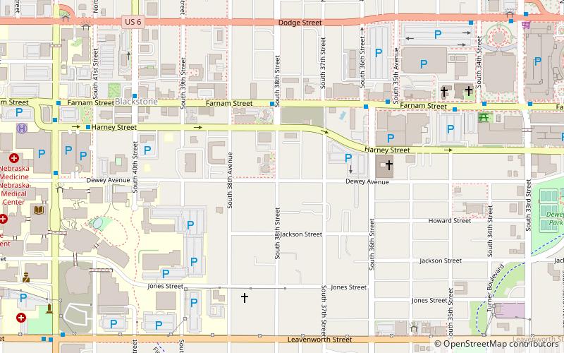
West Farnam neighborhood
The West Farnam neighborhood or the Blackstone neighborhood in Omaha, Nebraska is located from Dodge Street on the north to Leavenworth Street on the south, Highway 75/Interstate 480 on the east to South 52nd Street on the west.
Omaha Quartermaster Depot Historic District
The Omaha Quartermaster Depot Historic District, including several brick structures built in Italianate and other styles, was built for the U.S. Army between 1881 and 1894.

Minne Lusa
The Minne Lusa Residential Historic District is located in North Omaha, Nebraska. It is included on the National Register of Historic Places.

Dundee–Happy Hollow Historic District
The Dundee–Happy Hollow Historic District is located west of Midtown Omaha, Nebraska. It covers the area between Harney Street on the south, Hamilton Street on the north, Happy Hollow Boulevard on the west, and 46th Street on the east. The "heart" of Dundee is located at 50th and Underwood Avenue in Omaha, Nebraska, United States.

Old Gold Coast
Old Gold Coast is the name of a historic district in south Omaha, Nebraska. With South 10th Street as the central artery, the area was home to neighborhoods such as Little Italy and Forest Hill.

Field Club
Field Club is a neighborhood located in the Midtown region of Omaha, Nebraska. Roughly bounded by Pacific Street, 32nd Avenue, Center St. and 36th Street, the neighborhood was placed on the National Register of Historic Places as a historic district on November 15, 2000.
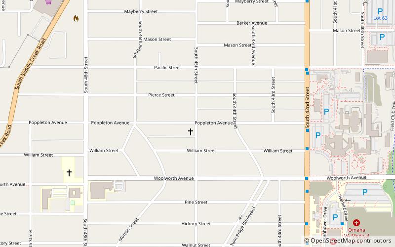
Morton Meadows
Morton Meadows is a historic neighborhood located in Midtown Omaha, Nebraska. The neighborhood lies between Center and Leavenworth Streets, from 42nd Street to Saddle Creek, and is sometimes referred to by its central boulevard, Twin Ridge.

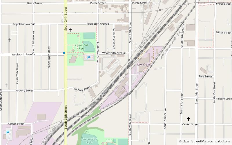
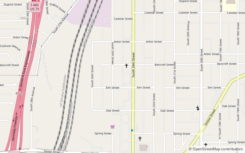
Vinton Street Commercial Historic District
The Vinton Street Commercial Historic District is located along Vinton Street between Elm Street on the west and South 17th Street on the east in south Omaha, Nebraska.

Drake Court Apartments and the Dartmore Apartments Historic District
The Drake Court Apartments and the Dartmore Apartments Historic District, built between 1916 and 1921, is located at Jones Street from 20th to 23rd Streets in Midtown Omaha, in the U.S. state of Nebraska.

Country Club Historic District
The Country Club Historic District is located in Omaha, Nebraska from 50th to 56th Streets, from Corby to Seward Streets. With dozens of homes built between 1925 and 1949 in the late 19th and 20th Century Revival styles, the community was added to the National Register of Historic Places in 2004.

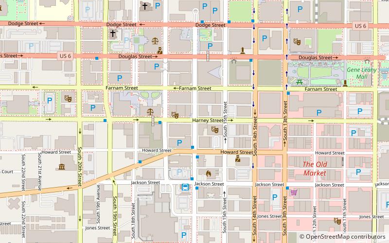
Omaha Rail and Commerce Historic District
The Omaha Rail and Commerce Historic District, roughly bounded by Jackson, 15th, and 8th Streets, as well as the Union Pacific main line, is located in downtown Omaha, Nebraska.

West Farnam Apartments
The West Farnam Apartments are located at 3817 Dewey Avenue in Midtown Omaha, Nebraska. The building was reportedly the first luxury apartment building constructed in Omaha.
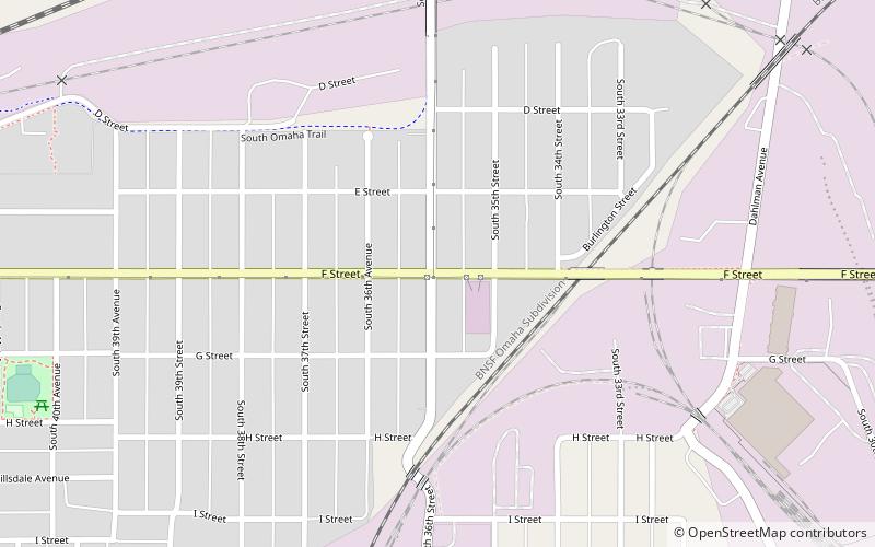
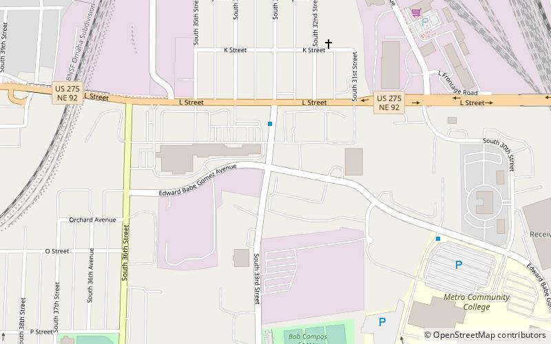
Burlington Road neighborhood
The Burlington Road neighborhood of Omaha, Nebraska is bordered by South 42nd Street on the west, L Street on the south, Interstate 80 on the north and Dahlman Avenue on the east.

Howard Street Apartment District
The Howard Street Apartment District is roughly bounded by Harney, South 22nd, Landon Court and South 24th Streets in downtown Omaha, Nebraska.
Sporting District
The Sporting District was an area near 16th and Harney Streets in Omaha, Nebraska where city boss Tom Dennison kept the majority of his gambling, drinking and prostitution interests from the late 19th century until the end of his reign in 1933.
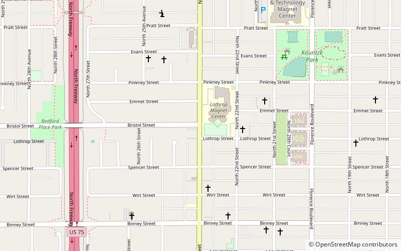
Kountze Place
The Kountze Place neighborhood of Omaha, Nebraska is a historically significant community on the city's north end. Today the neighborhood is home to several buildings and homes listed on the National Register of Historic Places.

Aksarben Village
Aksarben Village is a mixed-use development in the central United States, located in Omaha, Nebraska. Measuring over one million square feet, it is on the land of the former Ak-Sar-Ben coliseum and horse track.
Sheelytown
Sheelytown was a historic ethnic neighborhood in South Omaha, Nebraska, USA with populations of Irish, Polish and other first generation immigrants.
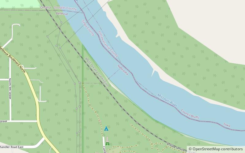
Gibson Bend
Gibson Bend of the Missouri River is a meander located in Pottawattamie County, Iowa and Douglas County, Nebraska, located at 41°11′15″N 95°55′15″W. The Gibson neighborhood is a community area in Omaha, Nebraska abutting the Gibson Bend.
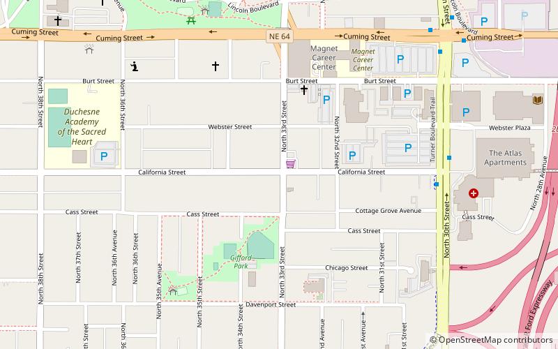
Gifford Park
Gifford Park is a historic neighborhood in midtown Omaha, Nebraska. It is roughly bounded by the North Freeway on the east, North 38th Street on the west, Dodge Street on the south and Cuming Street on the north.
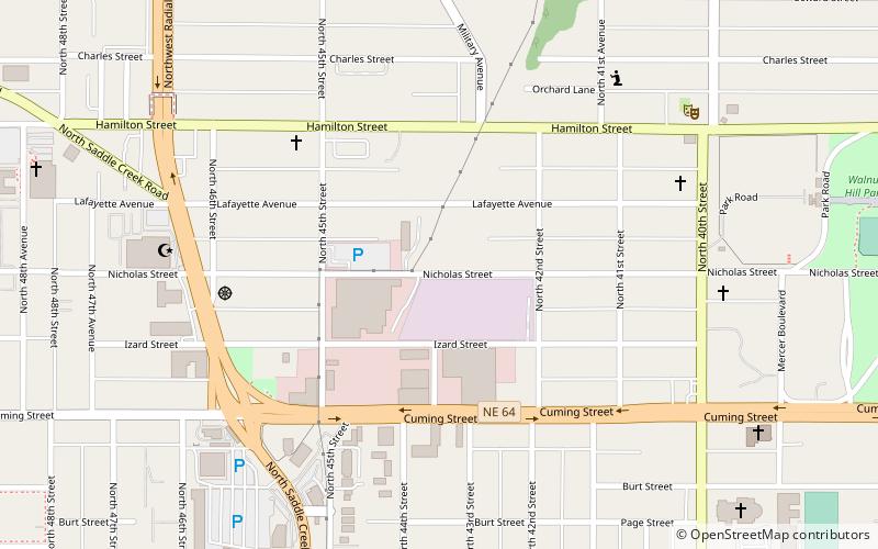
Walnut Hill
Walnut Hill is a historic neighborhood located in north Omaha, Nebraska. It is bounded by North 40th Street on the east, Cuming Street on the south, Northwest Radial Highway and Saddle Creek Road on the west and Hamilton Street on the north.
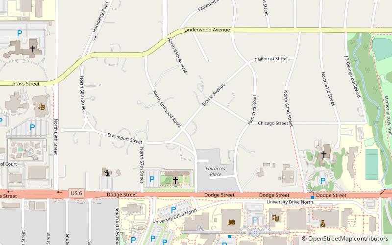
Fairacres Historic District
Fairacres is a neighborhood and historic district in Omaha, Nebraska. It is south of Dundee and west of Midtown. It is roughly bounded by Underwood Avenue to the north, Dodge Street to the south, North 69th Street to the west, and North 62nd Street to the east.
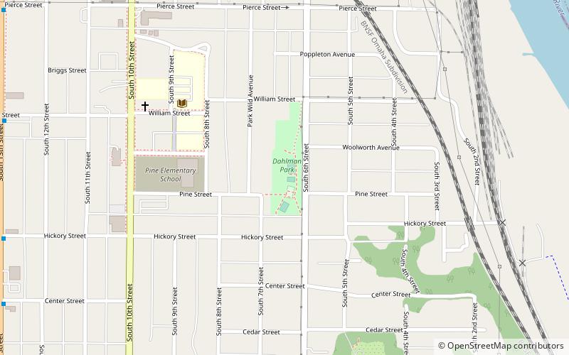
Dahlman neighborhood
The Dahlman neighborhood is located south of downtown Omaha, Nebraska. One of the oldest neighborhoods in the city, it was originally platted in 1856. It was later named after "Cowboy" James Dahlman, an eight-term mayor of Omaha.
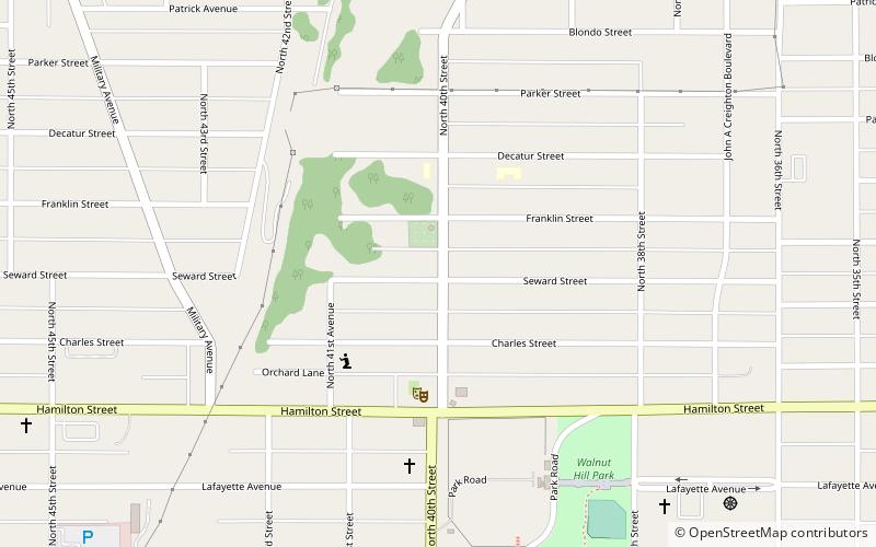
Orchard Hill
The Orchard Hill is a neighborhood in North Omaha, Nebraska. One of the oldest neighborhoods in the city, Orchard Hill is home to some of the city's oldest homes.
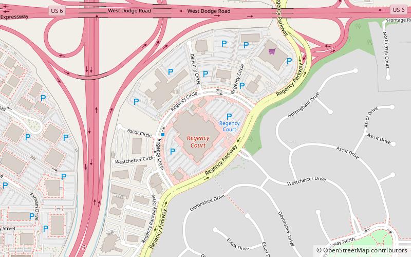
Regency
Regency is a neighborhood in Omaha, Nebraska. Bound by West Dodge Road, South 96th Street, Pacific Street and Interstate 680, the development was the first major real estate development funded by Mutual of Omaha.
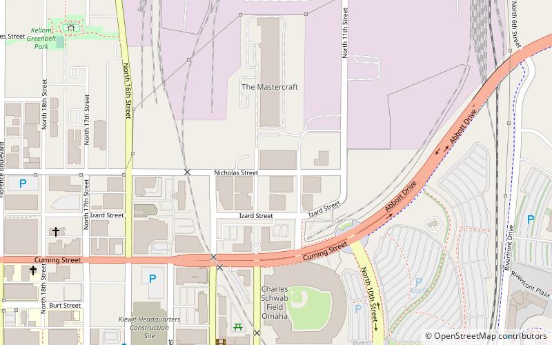
Nicholas Street Historic District
The Nicholas Street Historic District is a historic district in downtown Omaha, Nebraska. It is roughly bounded by 11th Street on the east, 14th Street to the west, and centered around Nicholas Street.
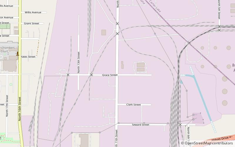
Squatter's Row
Squatter's Row was a historic neighborhood in the downtown area of Omaha, Nebraska. It was an area between North 11th and North 13th Streets, from Nicholas to Locust Streets, behind the Storz Brewery.

Benson
Benson is a historic neighborhood in Omaha, Nebraska. Now a pocket within North Omaha, Benson Place was originally platted in 1887 and was annexed into the City of Omaha in 1917.
Map
