Peak District: Valley
Places and attractions in the Valley category
Categories
- Natural attraction
- Nature
- Mountain
- Church
- Valley
- Lake
- Hill
- Archaeological site
- Gothic Revival architecture
- Hiking trail
- Hiking
- Cave
- Cliff
- Memorial
- Village
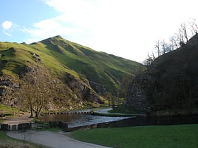
Dovedale
Dovedale is a valley in the Peak District of England. The land is owned by the National Trust, and annually attracts a million visitors.
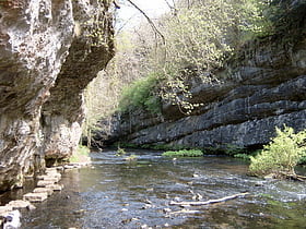
Chee Dale
Chee Dale is a steep-sided gorge on the River Wye near Buxton, Derbyshire, in the Peak District of England. Wye Dale continues upstream towards Buxton while downstream are Miller's Dale village and valley.
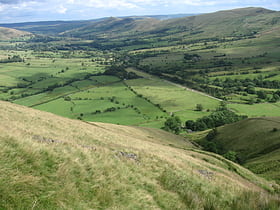
Vale of Edale
The Vale of Edale is the upper valley of the River Noe, in the Derbyshire Peak District of England. The village of Edale lies in the middle of the valley. Edale Head, on the Kinder Scout plateau, is the source of the River Noe.
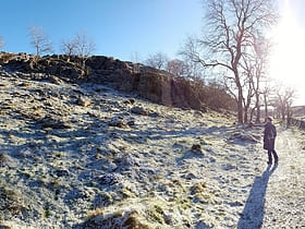
Hay Dale
Hay Dale is a short dry valley near Buxton, Derbyshire, in the Peak District of England. It is part of a longer valley that runs for approximately 4 miles north–south from Peak Forest to the River Wye at Millers Dale.
Cressbrook Dale
Cressbrook Dale is a dry carboniferous limestone gorge near Bakewell, Derbyshire, in the Peak District of England. The dale is cut into a plateau of farmland and lies to the south east of the village of Litton.
Cales Dale
Cales Dale is a short valley towards the head of Lathkill Dale near Monyash, Derbyshire in the Peak District of England. Cales Dale is included within Lathkill Dale as part of the Derbyshire Dales National Nature Reserve and is popular with tourists who visit for its natural environment and wildlife.
Monk's Dale
Monk's Dale is a short steep-sided dry gorge near Buxton, Derbyshire, in the Peak District of England. The dale is cut into a plateau of farmland and lies to the east of the village of Wormhill. The head of the valley leads into Peter Dale to the north. Miller's Dale is at the foot of the valley to the south.
Ballidon Dale
Ballidon Dale is a steep-sided, dry carboniferous limestone valley near Parwich in the Derbyshire Peak District of England. The ancient hamlet of Ballidon lies at the southern foot of the dale.
Long Dale
Long Dale is a carboniferous limestone valley near the village of Elton, Derbyshire, in the Peak District of England. The dale is cut into the plateau of Gratton Moor and Smerrill Moor and lies to the north of the hamlet of Pikehall, which is the venue of the annual Y Not Festival.
Peter Dale
Peter Dale is a short dry crag-sided valley near Buxton, Derbyshire, in the Peak District of England. There is a farmland plateau on either side.
Lathkill Dale
Lathkill Dale is the valley of the River Lathkill near Bakewell, Derbyshire in the Peak District of England. The river emerges into the dale from springs below Lathkill Head Cave. Towards the head of the dale is the side valley Cales Dale.
Monsal Dale
Monsal Dale is a valley in Derbyshire, England, in the White Peak limestone area of the Peak District National Park. It is a Site of Special Scientific Interest, a Special Area of Conservation and part of a Europe-wide network called Natura 2000.
Tideswell Dale
Tideswell Dale is a short dry limestone valley near Tideswell village, Derbyshire, in the Peak District of England. There is a farmland plateau on either side.
Upper Derwent Valley
The Upper Derwent Valley is an area of the Peak District National Park in England. It largely lies in Derbyshire, but its north eastern area lies in Sheffield, South Yorkshire.
Millers Dale
Millers Dale is a valley on the River Wye in Derbyshire, England, where there is also a hamlet of the same name. It is a popular beauty spot in the Peak District of England, much of the area being preserved as a Site of Special Scientific Interest.
Middleton Dale
Middleton Dale is a steep-sided, carboniferous limestone valley in the Derbyshire Peak District of England. The village of Stoney Middleton lies at the eastern foot of the dale and the village of Eyam lies about 600 metres to the north, through the side valley of Eyam Dale.
Coombs Dale
Coombs Dale is a steep-sided, dry carboniferous limestone valley in the Derbyshire Peak District of England. The village of Calver lies about 1 km to the east and the village of Stoney Middleton lies less than 1 km to the north.
Hope Valley
The Hope Valley is a rural area centred on the village of Hope, Derbyshire, in the Peak District in the northern Midlands of England. The name also applies to the post town that includes the surrounding villages.
Bradfield Dale
Bradfield Dale is a rural valley 12 kilometres west-northwest of the City of Sheffield in England. The valley stands within the north-eastern boundary of the Peak District National Park just west of the village of Low Bradfield.
Via Gellia
Via Gellia is a steep-sided wooded dry valley and road in Derbyshire. It is probably named after Philip Eyre Gell in a mock-Latin style; he was responsible for building the road through the valley, the name being a link to the Gell family's claim of Roman descent.
Map

