Peak District: Mountain
Places and attractions in the Mountain category
Categories
- Natural attraction
- Nature
- Mountain
- Church
- Valley
- Lake
- Hill
- Archaeological site
- Gothic Revival architecture
- Hiking trail
- Hiking
- Cave
- Cliff
- Memorial
- Village
Kinder Scout
Kinder Scout is a moorland plateau and national nature reserve in the Dark Peak of the Derbyshire Peak District in England. Part of the moor, at 636 metres above sea level, is the highest point in the Peak District, the highest point in Derbyshire, and the highest point in the East Midlands.
Thorpe Cloud
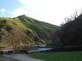
Thorpe Cloud is an isolated limestone hill lying between the villages of Thorpe and Ilam on the Derbyshire/Staffordshire border at the southern end of Dovedale.
Win Hill
Win Hill is a hill north west of Bamford in the Derbyshire Peak District of England. Its summit is 462 m above sea level and it is bounded by the River Derwent to the east, the River Noe to the south west and Ladybower Reservoir to the north, with a ridge running north west linking it to Kinder Scout.
Harthill Moor
Harthill Moor is a small upland area in the Derbyshire Peak District of central and northern England, lying between Matlock and Bakewell near the villages of Birchover and Elton. The moor is within the southern portion of Harthill civil parish. Its highest point is 272 metres above sea level.
Chrome Hill
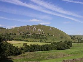
Chrome Hill is a limestone reef knoll in Derbyshire, England, in the upper Dove valley beside the border with Staffordshire. It is adjacent to Parkhouse Hill, another reef knoll. Chrome Hill was declared open access land under the provisions of the Countryside and Rights of Way Act 2000.
Mill Hill
Mill Hill is an open, flat-topped hill, 544 metres high, in the Peak District in the county of Derbyshire in England.
High Edge
High Edge is a limestone hill overlooking Harpur Hill, Buxton in Derbyshire, in the Peak District. The summit is 472 metres above sea level. The lower hilltop is marked by a cairn. Following the Countryside and Rights of Way Act 2000, this hilltop area became "Open Access" land for the public.
Black Hill
Black Hill, in the Peak District, is the highest hill in West Yorkshire, England. Its summit has a maximum elevation of 582 m above sea level. It is surpassed in height by only two other major summits in the Peak District. Black Hill is a typical Pennine moorland mountain, with a very flat and extensive plateau.
Parkhouse Hill
Parkhouse Hill is a small but distinctive hill in the Peak District National Park in the English county of Derbyshire. It lies on the north side of the River Dove, close to the border with Staffordshire.
Burbage Edge
Burbage Edge is a gritstone escarpment overlooking the Burbage district of Buxton in Derbyshire, in the Peak District. The hill's summit is 500 metres above sea level. Not to be confused with the Burbage Rocks extension of Stanage Edge near Hathersage.
Lose Hill
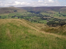
Lose Hill lies in the Derbyshire Peak District. It is the south-east corner of the parish of Edale and the end of the Great Ridge that runs from Rushup Edge to the west. Local access activist G. H. B.
Eyam Moor
Eyam Moor is a plateau-topped hill between the villages of Eyam and Hathersage in Derbyshire, in the Peak District of England. The summit of Sir William Hill is 429 metres above sea level. It is unclear whom Sir William Hill is named after.
Beeley Moor
Beeley Moor is a small gritstone upland area in the Derbyshire Peak District of central and northern England, near the villages of Beeley and Baslow. Its highest point is 371 metres above sea level.
Minninglow
Minninglow is a hill in the Peak District National Park in Derbyshire, located within the White Peak area at grid reference SK209573. Within the clump of trees crowning the hill are a Neolithic chambered tomb and two Bronze Age bowl barrows. The chambered tomb and barrows are a Scheduled Monument.
Lantern Pike
Lantern Pike is a hill located just outside Hayfield, in Derbyshire, England. The land lies within the Peak District National Park and is owned and maintained by the National Trust. It is permanently open to the public. According to Ordnance Survey, it is 373 metres in height.
High Wheeldon
High Wheeldon is a distinctive dome-shaped hill near the Staffordshire border in Derbyshire, in the Peak District valley of Upper Dovedale, overlooking the villages of Earl Sterndale, Longnor and Crowdecote.
Brown Knoll
Brown Knoll is one of the highest hills in the Peak District in central England. It rises to a height of 569 metres above the head of the Edale valley and about 3 kilometres south-southwest of the Peak's highest point, Kinder Scout.
Rushup Edge
Rushup Edge is a ridge in the Derbyshire Peak District of England. The ridge's highest point is Lord's Seat at 550 m, while Mam Tor lies at its eastern end, beyond which the Great Ridge runs. Lord's Seat is a round barrow.
Hollins Cross
Hollins Cross lies between Mam Tor and Lose Hill on the Great Ridge that separates Castleton and Edale in Derbyshire, England. Hollins Cross is the lowest point on the ridge and is therefore a popular route taken by walkers wishing either to cross from one side to the other, or to start a walk along the ridge.
Eldon Hill
Eldon Hill is a hill in the Peak District National Park in the county of Derbyshire, England, 4 kilometres southwest of the village of Castleton. It is a 470-metre limestone hill whose pastureland is used for rough grazing, although a large proportion has been lost to limestone quarrying.
Crook Hill
Crook Hill is a small hill in the Peak District National Park in the English county of Derbyshire, 5 kilometres northeast of Castleton.
Totley Moor
Totley Moor is an open moorland hill to the west of the Sheffield suburb of Totley, in the Derbyshire Peak District. The summit is 395 metres above sea level.
Gardom's Edge
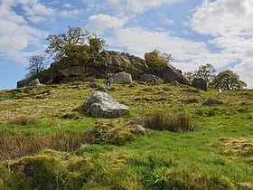
Gardom's Edge is a rocky outcrop near Baslow in Derbyshire, England. The shelf between Gardom's Edge and Birchen Edge is now moorland used for grazing sheep, but was inhabited and arably farmed during the Bronze Age.
Lost Lad
Lost Lad is a hill, 518 metres high on the Derwent Edge in the Peak District in the county of Derbyshire in England. It is a subpeak of Back Tor.
Oliver Hill
Oliver Hill is a hill, 513 metres high, in the Peak District in the county of Staffordshire in England. It is a treeless summit surrounded by farmland in the southern part of the Peak District about 6 kilometres south-southwest of the town of Buxton.
Stanton Moor
Stanton Moor is a small upland area in the Derbyshire Peak District of central and northern England, lying between Matlock and Bakewell near the villages of Birchover and Stanton-in-Peak.
Saddleworth Moor
Nature area with trails and scenic views Saddleworth Moor is a moorland in North West England. Reaching more than 1,312 feet above sea level, it is in the Dark Peak area of the Peak District National Park. It is crossed by the A635 road and the Pennine Way passes to its eastern side.
Grindslow Knoll
Grindslow Knoll is a hill in the Dark Peak area of the Peak District National Park in Derbyshire, England. It is joined to Kinder Scout by a high col though from most angles appears as an independent peak.
Great Ridge
Great Ridge is a ridge separating the vales of Edale and Castleton in Derbyshire, England. It extends for approximately 3 kilometres from Mam Tor at the western end of the ridge to Lose Hill at the eastern end, the lowest point being Hollins Cross.
Taddington Moor
Taddington Moor is a limestone hill between the villages of Taddington, Flagg and Chelmorton in the Derbyshire Peak District. The moor is an upland farming landscape. The summit at Sough Top is 438 metres above sea level.
Featherbed Top
Featherbed Top is an open, flat-topped hill, 544 metres high, in the Peak District in the county of Derbyshire in England.
Gibbet Moor
Gibbet Moor is a small gritstone upland area in the Derbyshire Peak District of central and northern England, near the village of Baslow. Its highest point is 295 metres above sea level. The Chatsworth Estate lies to the west and Umberley Brook run along its east edge.
Bradwell Moor
Bradwell Moor is a moorland hill above the village of Bradwell, Derbyshire in the Peak District. The summit is 471 metres above sea level. Batham Gate Roman road ran across the moor, from nearby Navio Roman fort to Aquae Arnemetiae. Batham Gate is Old English for "road to the bath town".
Longstone Edge
Longstone Edge is a limestone ridge in the Peak District National Park, in Derbyshire, England. Longstone Edge is immediately north of the village of Great Longstone, which is in turn about 3 kilometres north of the town of Bakewell.
Gun
Gun is a hill at the southern end of the Peak District, overlooking the town of Leek in the Staffordshire Moorlands. The hill is mainly moorland with some small wooded areas. Neighbouring peaks to the east are The Roaches, Hen Cloud and Ramshaw Rocks. It is a nature reserve of the Staffordshire Wildlife Trust.
Black Edge
Black Edge is a summit, 507 metres high, on a sharp ridgeline above the village of Dove Holes in the Dark Peak area of the Peak District in the county of Derbyshire in England.
Calton Hill
Calton Hill is a Site of Special Scientific Interest in Derbyshire, England, showing Olivine Diorite magma chamber. It is the site of an extinct volcano and the quarrying that has now been abandoned means that it is possible to observe the geological structures caused by the repeated eruptions.
Map

