Peak District: Natural Attraction
Places and attractions in the Natural attraction category
Categories
- Natural attraction
- Nature
- Mountain
- Church
- Valley
- Lake
- Hill
- Archaeological site
- Gothic Revival architecture
- Hiking trail
- Hiking
- Cave
- Cliff
- Memorial
- Village
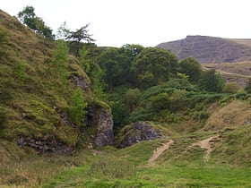
Odin Mine
Nestled in the heart of the Peak District, Odin Mine stands as a testament to the region's rich industrial past and has emerged as a distinctive tourist attraction in England. This ancient lead mine, which is one of the oldest documented mines in the country, offers...
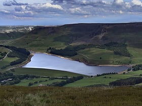
Dovestone Reservoir
Dovestone Reservoir lies at the convergence of the valleys of the Greenfield and Chew Brooks above the village of Greenfield, on Saddleworth Moor in Greater Manchester, England. The reservoir is on the western edge of the Peak District National Park.
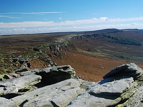
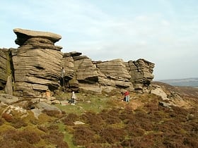
Stanage Edge
Landmark destination for rock climbers Stanage Edge, or simply Stanage is a gritstone escarpment in the Peak District, England, famous as a location for climbing. It lies a couple of miles to the north of Hathersage, and the northern part of the edge forms the border between the High Peak of Derbyshire and Sheffield in South Yorkshire.
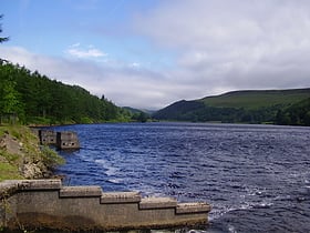
Derwent Reservoir
Derwent Reservoir is the middle of three reservoirs in the Upper Derwent Valley in the north of Derbyshire, England. It lies approximately 10 miles from Glossop and 10 miles from Sheffield.
Lud's Church
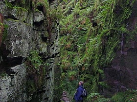
Lud's Church is a deep chasm penetrating the Millstone Grit bedrock created by a massive landslip on the hillside above Gradbach, Staffordshire, England.
Ladybower Reservoir
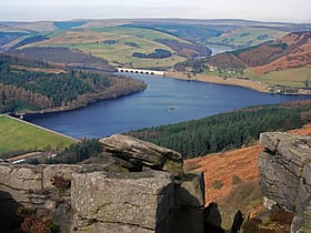
Waterway for scenic walks and hikes Ladybower Reservoir is a large Y-shaped, artificial reservoir, the lowest of three in the Upper Derwent Valley in Derbyshire, England.
Kinder Scout
Kinder Scout is a moorland plateau and national nature reserve in the Dark Peak of the Derbyshire Peak District in England. Part of the moor, at 636 metres above sea level, is the highest point in the Peak District, the highest point in Derbyshire, and the highest point in the East Midlands.
Dovedale
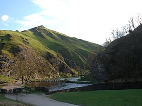
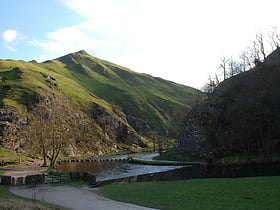
Dovedale is a valley in the Peak District of England. The land is owned by the National Trust, and annually attracts a million visitors.
Howden Reservoir
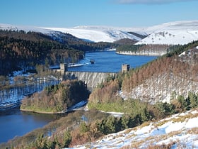
The Howden Reservoir is a Y-shaped reservoir, the uppermost of the three in the Upper Derwent Valley, England. The western half of the reservoir lies in Derbyshire and the eastern half is in Sheffield, South Yorkshire; the county border runs through the middle of the reservoir, following the original path of the River Derwent.
Thorpe Cloud
Thorpe Cloud is an isolated limestone hill lying between the villages of Thorpe and Ilam on the Derbyshire/Staffordshire border at the southern end of Dovedale.
Damflask Reservoir
Damflask Reservoir is situated at grid reference SK277907 five miles west of the centre of Sheffield in the Loxley valley close to the village of Low Bradfield and within the city's boundaries. The hamlet of Stacey Bank is located to the east.
Titan Cave
Titan is a natural cavern near Castleton in the Derbyshire Peak District, and is the deepest shaft of any known cave in Britain, at 141.5 metres.
Higger Tor
Higger Tor or Higgar Tor is a gritstone tor in the Dark Peak, in the north of the Peak District National Park in England. It overlooks the Burbage Valley and the Iron Age hill fort of Carl Wark to the southeast.
Win Hill
Win Hill is a hill north west of Bamford in the Derbyshire Peak District of England. Its summit is 462 m above sea level and it is bounded by the River Derwent to the east, the River Noe to the south west and Ladybower Reservoir to the north, with a ridge running north west linking it to Kinder Scout.
The Roaches
The Roaches is a prominent rocky ridge above Leek and Tittesworth Reservoir in the Staffordshire Peak District of England. The ridge with its rock formations rises steeply to 505 m.
Padley Gorge
Padley Gorge is a deep but narrow valley in the Peak District, Derbyshire between the village of Grindleford and the A6187 road. The gorge is wooded with a stream, the Burbage Brook.
Derwent Edge
Derwent Edge is a Millstone Grit escarpment that lies above the Upper Derwent Valley in the Peak District National Park in the English county of Derbyshire. An Ordnance Survey column marks the highest point of the Edge at Back Tor. North of Back Tor the edge extends into Howden Edge and enters the county of South Yorkshire.
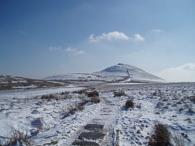
Shutlingsloe
Shutlingsloe is a hill near the village of Wildboarclough, in the east of the county of Cheshire. It stands to the south of Macclesfield Forest, on the edge of the Peak District and within the Peak District National Park.
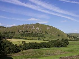
Chrome Hill
Chrome Hill is a limestone reef knoll in Derbyshire, England, in the upper Dove valley beside the border with Staffordshire. It is adjacent to Parkhouse Hill, another reef knoll. Chrome Hill was declared open access land under the provisions of the Countryside and Rights of Way Act 2000.
Errwood Reservoir
Errwood Reservoir is a drinking-water reservoir in the Peak District National Park, within the county of Derbyshire and very close to the boundary with Cheshire.
Froggatt Edge
Froggatt Edge is a gritstone escarpment in the Dark Peak area of the Peak District National Park, in Derbyshire, England, close to the villages of Froggatt, Calver, Curbar, Baslow and Grindleford.
Mill Hill
Mill Hill is an open, flat-topped hill, 544 metres high, in the Peak District in the county of Derbyshire in England.
Agden Reservoir
Agden Reservoir is a water storage reservoir, situated at grid reference SK260925, 6.5 miles west of the centre of Sheffield, South Yorkshire, England. It is owned by Yorkshire Water / Kelda Group.
Blakemere Pond
Blakemere Pond, also known as Black Mere Pool or Mermaid's Pond, is a small, natural lake in Staffordshire, England, six miles north-west of Leek. The pond is the subject of an enduring legend that claims that the water is haunted by the ghost of a mermaid.
Bamford Edge
Bamford Edge is an overhang of gritstone rock that sticks out north of the village of Bamford, Hope Valley, in the English county of Derbyshire. The first ascent of "Smoked Salmon", which is graded as E8 7b was made by British climber Johnny Dawes.
Black Hill
Black Hill, in the Peak District, is the highest hill in West Yorkshire, England. Its summit has a maximum elevation of 582 m above sea level. It is surpassed in height by only two other major summits in the Peak District. Black Hill is a typical Pennine moorland mountain, with a very flat and extensive plateau.
Shining Tor
Shining Tor is the highest hill in the modern ceremonial county of Cheshire, England. The summit has a maximum elevation of 559 m above sea level.
Rivelin Rocks
Rivelin Rocks are a gritstone edge or escarpment in the upper Rivelin Valley at grid reference SK279873, 9 kilometres west of Sheffield just off the A57 road in the county of South Yorkshire, England.
Parkhouse Hill
Parkhouse Hill is a small but distinctive hill in the Peak District National Park in the English county of Derbyshire. It lies on the north side of the River Dove, close to the border with Staffordshire.
Lose Hill
Lose Hill lies in the Derbyshire Peak District. It is the south-east corner of the parish of Edale and the end of the Great Ridge that runs from Rushup Edge to the west. Local access activist G. H. B.
Redmires Reservoirs
The Redmires Reservoirs are a group of three reservoirs in Fulwood, Sheffield, South Yorkshire, England. They are fed from the Hallam Moors by various small streams including Fairthorn Clough.
Minninglow
Minninglow is a hill in the Peak District National Park in Derbyshire, located within the White Peak area at grid reference SK209573. Within the clump of trees crowning the hill are a Neolithic chambered tomb and two Bronze Age bowl barrows. The chambered tomb and barrows are a Scheduled Monument.
Lantern Pike
Lantern Pike is a hill located just outside Hayfield, in Derbyshire, England. The land lies within the Peak District National Park and is owned and maintained by the National Trust. It is permanently open to the public. According to Ordnance Survey, it is 373 metres in height.
High Wheeldon
High Wheeldon is a distinctive dome-shaped hill near the Staffordshire border in Derbyshire, in the Peak District valley of Upper Dovedale, overlooking the villages of Earl Sterndale, Longnor and Crowdecote.
Brown Knoll
Brown Knoll is one of the highest hills in the Peak District in central England. It rises to a height of 569 metres above the head of the Edale valley and about 3 kilometres south-southwest of the Peak's highest point, Kinder Scout.
Rushup Edge
Rushup Edge is a ridge in the Derbyshire Peak District of England. The ridge's highest point is Lord's Seat at 550 m, while Mam Tor lies at its eastern end, beyond which the Great Ridge runs. Lord's Seat is a round barrow.
Hollins Cross
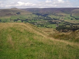
Hollins Cross lies between Mam Tor and Lose Hill on the Great Ridge that separates Castleton and Edale in Derbyshire, England. Hollins Cross is the lowest point on the ridge and is therefore a popular route taken by walkers wishing either to cross from one side to the other, or to start a walk along the ridge.
Eldon Hill
Eldon Hill is a hill in the Peak District National Park in the county of Derbyshire, England, 4 kilometres southwest of the village of Castleton. It is a 470-metre limestone hill whose pastureland is used for rough grazing, although a large proportion has been lost to limestone quarrying.
Crook Hill
Crook Hill is a small hill in the Peak District National Park in the English county of Derbyshire, 5 kilometres northeast of Castleton.
Margery Hill
Margery Hill is a 546-metre hill on the Howden Moors in South Yorkshire, England. It lies towards the northern boundary of the Peak District National Park, between Langsett Reservoir to the northeast and Howden Reservoir to the southwest.
Gardom's Edge
Gardom's Edge is a rocky outcrop near Baslow in Derbyshire, England. The shelf between Gardom's Edge and Birchen Edge is now moorland used for grazing sheep, but was inhabited and arably farmed during the Bronze Age.
Lost Lad
Lost Lad is a hill, 518 metres high on the Derwent Edge in the Peak District in the county of Derbyshire in England. It is a subpeak of Back Tor.
Giant's Hole
Giant's Hole is a well-known cave near Castleton in Derbyshire, consisting mostly of large passages. It is a stream-way cave, and part of the Karst topography of the area.
Macclesfield Forest
Macclesfield Forest is an area of woodland, predominantly conifer plantation, located around 3 mi south east of Macclesfield in the civil parish of Macclesfield Forest and Wildboarclough, in Cheshire, England.
Monsal Dale
Monsal Dale is a valley in Derbyshire, England, in the White Peak limestone area of the Peak District National Park. It is a Site of Special Scientific Interest, a Special Area of Conservation and part of a Europe-wide network called Natura 2000.
Map

